The Backcountry Discovery Route gets civilized
Civilization as I define it has been largely absent from previous big moto trips. We crossed the Sierra de San Pedro Mártir mountains in Baja without encountering a soul. We found nothing but abandoned mines in the Jalisco hills. I crossed the majority of western Colorado with nothing but the hum of my engine to keep me company. We stood adopt the rim of the Grand Canyon with nary a tourist sullying our views. We encountered more cows than people while crossing the whole darn country on the Transamerica Trail.
Knowing that great moto terrain and urban areas are usually inversely correlated, I was quite curious when our friends at Backcountry Discover Routes announced the Southern California BDR. The California I knew was full of people, roads, cars, and governed by extremely strict land-use regulations. I heard word of legendary moto ranches dotting the inland empire and infamous desert races like the Mint 400 immortalized by Hunter S. Thompson’s Fear and Loathing in Las Vegas, but it really didn’t occur to me that a backcountry route could be assembled across this fine state.
When the route dropped last Fall, we were impressed. It connected the Mexico-California border to the northern end of Owens Valley, hugging Nevada and diving in and out of Death Valley National Park. However, we could do better. We unsheathed our geospatial scalpels began excising graded roads and replacing them with single track and washes.
After the operation, we were left with the Southern California Backcountry Discovery Route++, a picturesque, nearly-all-off-road route from Death Valley to the Sierras and back that combines beautiful vistas with fantastic riding. Every section doable on a big bike, but the difficulty level is substantially higher than the default BDR. If you are not comfortable getting your GS1200 over a 3-foot step, this route is probably not for you.
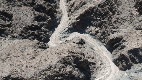
The map below showcases our actual tracks (available full-screen here), which deviated slightly from our original plan. In each day’s section, I’ll discuss alternate routes and the decisions that led us to the final Southern California Backcountry Discovery Route++.
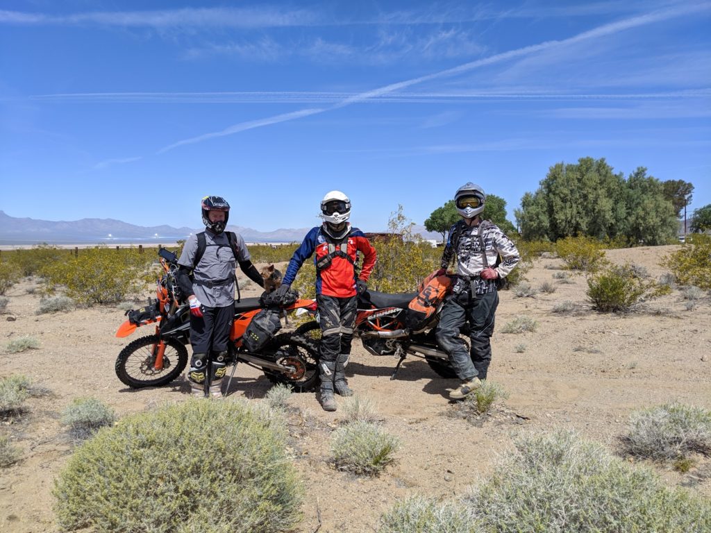
Note: credit needs to be given where credit is due. The best pictures were all taken by Carl Walker and Tom McKinnon, who also spent their free time planning this phenomenal route while I was lazing on my couch eating Cheetos and watching Planet Earth. My only role in this affair was that of a scribe and and passive participant.
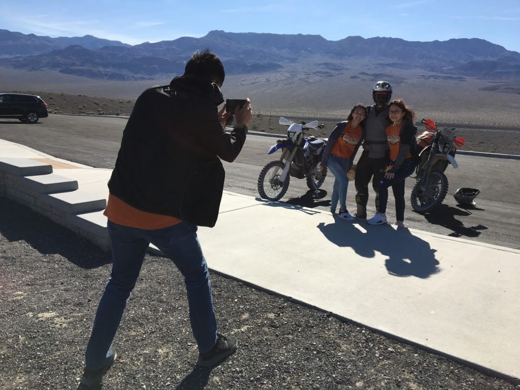
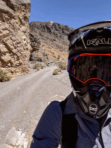
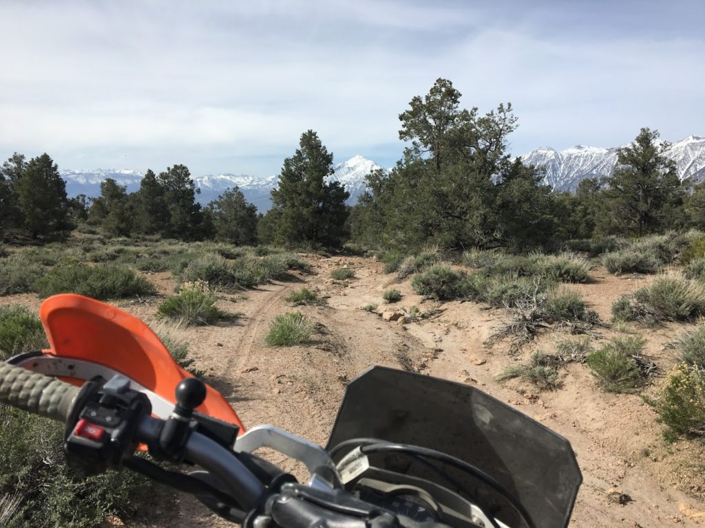
Day 1: Nipton to Avi or where else can you ride 30 miles of single track and end your day at a beach resort?
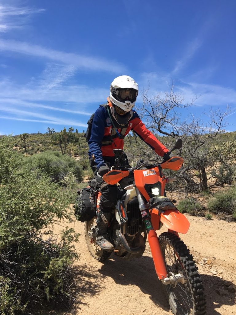
Day 1 started inauspiciously. Not having unloaded a motorcycle since our last trip, I proceeded to back the big KTM 690 off the trailer, slightly miss the balance point, and drop it in the dirt parking lot of the Magic Nipton resort. Yes, the Magical Nipton you’ve read all about in the New York Times was the starting point for our trip. The same Magical Nipton that was purchased by cannabis companies CannAwake Corporation and American Green for the purpose of creating a marijuana oasis in the middle of the Mojave desert from the corpse of a 1930s break-of-bulk trading post. Weirder things have happened.
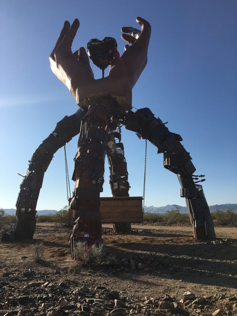
Magical Nipton’s transformation to a cannabis paradise was marked by the erection of these monuments to Burning Man culture.
Let me back up. The reason we found ourselves in Magical Nipton to begin with was because the architects of the BDR apparently don’t have jobs. All of their routes traverse a state leaving how to return to the starting point to each rider’s imagination. For this California in particular, finding a place to leave a trailer for eight days was challenging, but the friendly folk from Magical Nipton generously offered us a few square meters of their compound. This meant we could start our route here, take the Southern California BDR north, cross the Black Mountains, and catch the Nevada BDR back to Nipton.
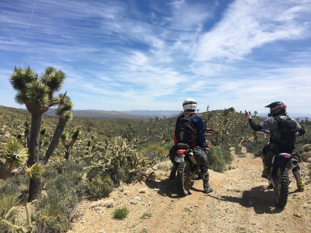
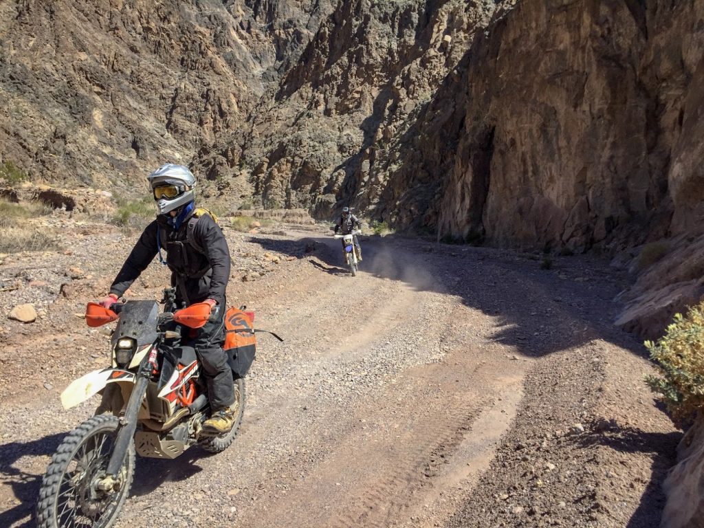
Lots of chatting and pointing on these labyrinthine mining roads.
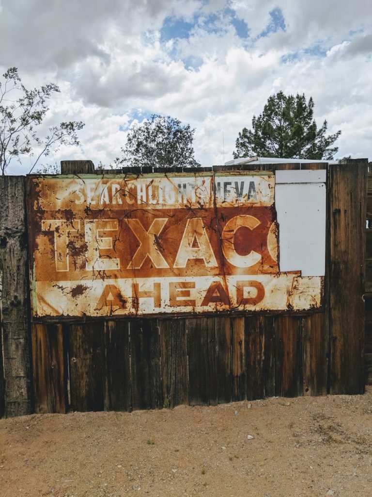
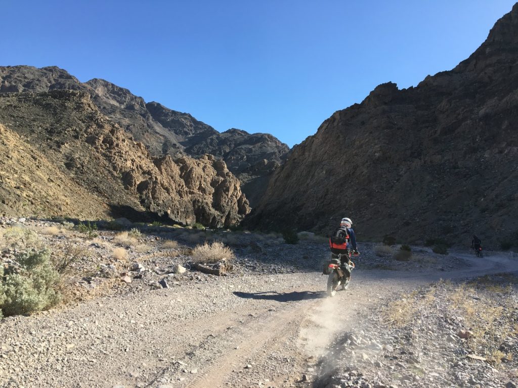
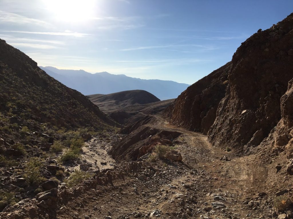
Our trip started out with a bang. 100 yards after leaving Nipton, we dropped into a deep sand wash and picked our way through a labyrinth of rocky mining roads decorated with DANGER and NO TRESPASSING signs. After navigating around a few dead-ends and old mine shafts, we found ourselves on a beautiful, banked powdery motocross track that led us into Searchlight, NV, the hometown of Harry Reid, once the fourth most powerful man in America.
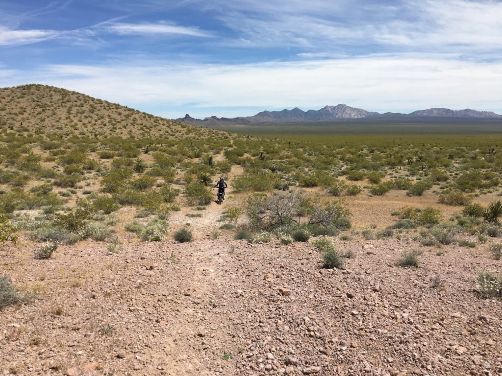
We spent most of the afternoon riding flowing single track to the Colorado River’s finest beach resort.
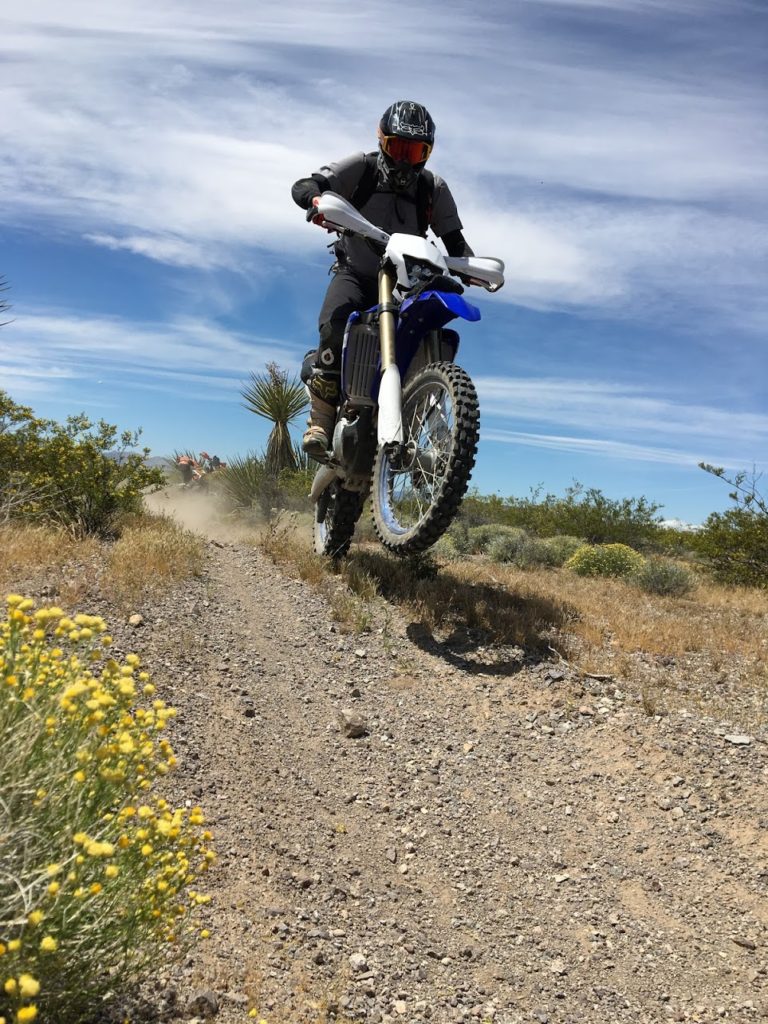
The stock BDR route follows an arrow-straight graded road nearly into Needles. Fortunately, Carl’s eagle eye for great trails (a skill that would come in very useful on this trip) noticed a faint single track crossing the road shortly outside of Searchlight. Given that they sold race gas at the only station in town, Carl put two and two together an intuited that a pretty great trail system must exist in the area. He was right. We rode 30+ miles of beautiful flowing singletrack almost all the way into Bullhead City where we fueled up and grabbed a quick lunch break.
After lunch, we buzzed a transmission-line road through the hills south of Bullhead City and ended the ride at Avi Casino Resort, home to the best beach on the Colorado River. If you’re not camping, I would strongly recommend staying here over a stabbin’ cabin in Needles or the environs. Rooms were cheap, beers were cold, and food was supersized.
How often does a point-to-point desert ride end at a beach resort?
Day 2: Avi to Nipton or they really know how to cut trails in eastern California
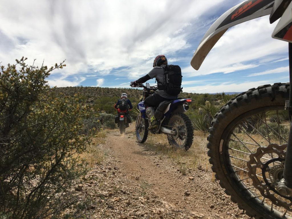
We began the day with a quick jaunt down River Rd. to fuel up in Needles and get back on track. In no time, we were back to riding miles of perfect motorcycle single track. The people of Needles, CA are also apparently dirt bike enthusiasts and build quite the playground just to the west of town.

Moto singletrack abounds outside of Needles, CA
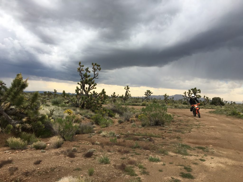
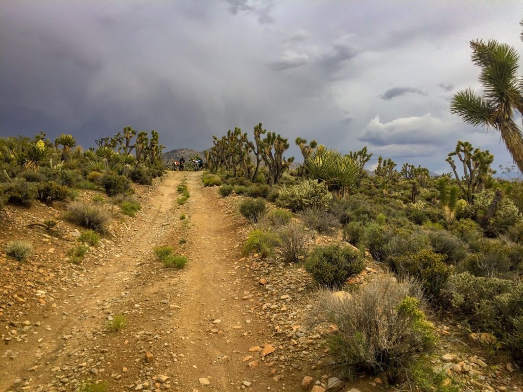
As visible in the foreboding clouds, a storm was brewing. After following several trails until they dead-ended into the Mojave Trails National Monument, a few drops of rain convinced us that we needed to skedaddle. Several weeks prior, the triple-digit temperatures gave us all pause, so we felt fortunate for the rain and the wind, but being smitten by lightning in the middle of the Mojave did not align with any of our life plans.
We buzzed out of the Needles OHV area and picked up a railroad service road that appeared to reconnect with the BDR. Inserting a brief detour to take in Flattop Mountain, we hustled to Goffs, an old rail station and military camp, to take shelter.
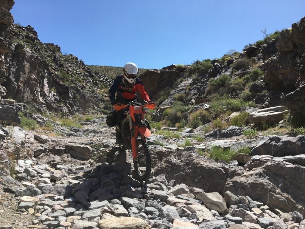
First crash of the trip! This road transitioned from graded to steep and rocky faster than my daydreaming brain could downshift.
By the time we arrived in Goffs, the sky was booming. Aside from the ever-present transmission towers that seem to mark every eastern California landscape, our figures perched atop motorcycles represented the highest points for miles. Fortunately, the storm couldn’t have come at a better moment. Goffs is a former railroad town that was totally abandoned in 1931 after Route 66 enabled a direct connection between Needles and Essex. The town fell into disrepair for 50 years, but recently the Mojave Desert Heritage and Cultural Association has taken an interest in restoring the site and opened an interesting museum in the old school house. While thunder boomed outside, we learned about all about mining and the WWII-era desert training camp that Patton set up in Goffs (ironically, the soldiers shipped off to Alaska).
The Goffs museum is full of all kinds of curious artifacts. Their property is open for camping for those so inclined.
Once the storm died, we burned out of Goffs on mixed BDR/BLM road sections. The rain created true hero conditions over the whooped double track and turned all three of us into motocross legends. Flying through the desert, guided by the pointing Joshua Trees, we made our way to Cima, where the trail ended in an open wash. We navigated the freshly watered wash like captains of the Africa Queen making their first cruise up the Nile and returned to our home away from home in Magical Nipton.
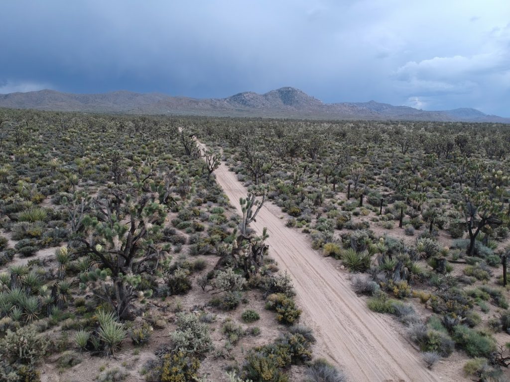
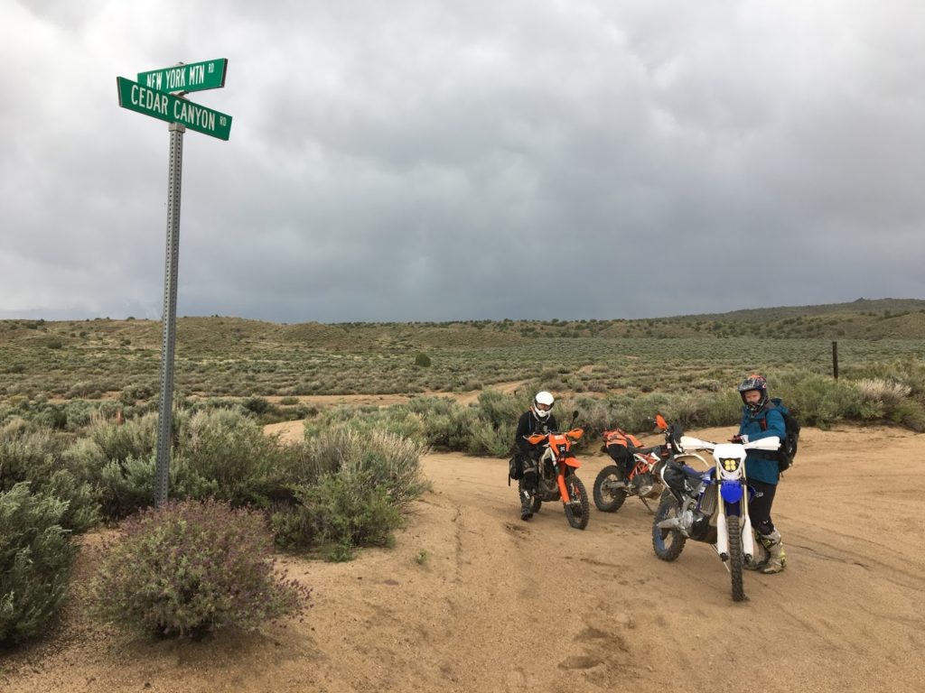
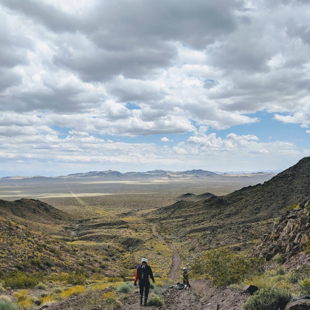
Clockwise: The rain created hero conditions on the doubletrack connecting Goffs to Nipton; Ripping big motocross turns through the middle of nowhere will put a smile on any face; The intersection of New York Mountain Rd. and Cedar Canyon Rd. is >50 miles from any paved road. The San Bernardino County DOT must have some time on its hands.
Day 3: Nipton to Furnace Creek or escaping the desert obelisks
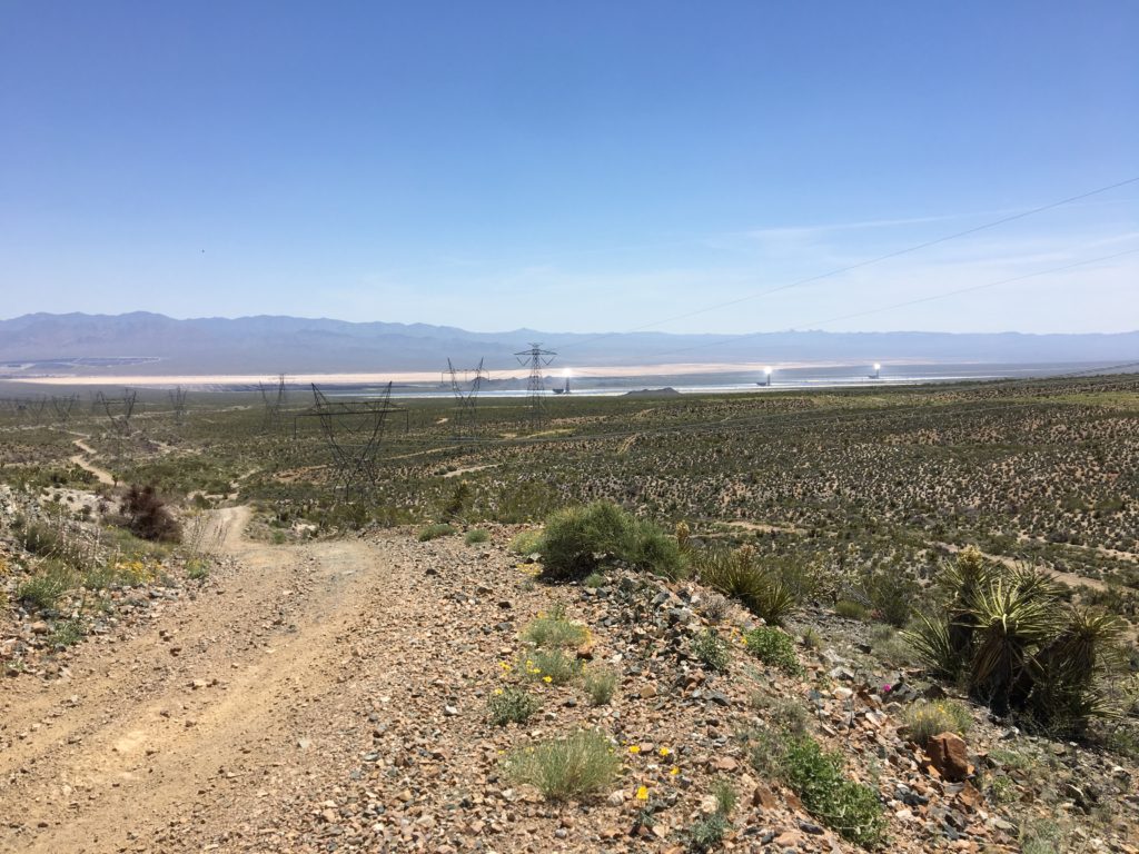
The Ivanpah solar plant had been tempting us since the beginning. Consisting of three Eyes of Sauron towering high over I-15, it provides 400 MW of clean energy to neighboring metropolises by focusing sunlight incident on 3,500 acres on three small water reservoirs using 173,500 mirrors. If you haven’t laid eyes upon this installations, you should. The sight of three glowing cubes 450 feet above the desert sand causes enough confusion on the interstate that there is a nearly permanent traffic jam in the vicinity.
Fortunately for us, the SCBDR passes right undernearth these engineering spectacles. We rode a washy road out of Nipton, fueled up in Primm, and climbed up to the notorious Colosseum Mine. This climb is marked as steep and rocky on the BDR map and caused quite a few tumbles in their ride report, but is mild compared to most of the Southern California Backcountry Discovery Route++.
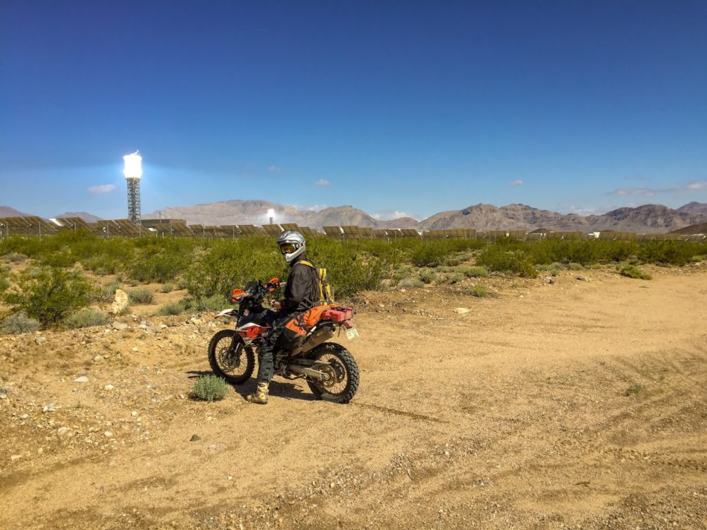
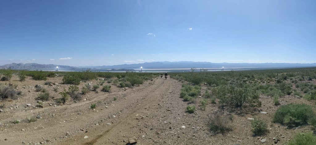
The glowing obelisks of Ivanpah Power Station watched our every move before lunch. Top-right: the top of the climb up to Colosseum Mine.
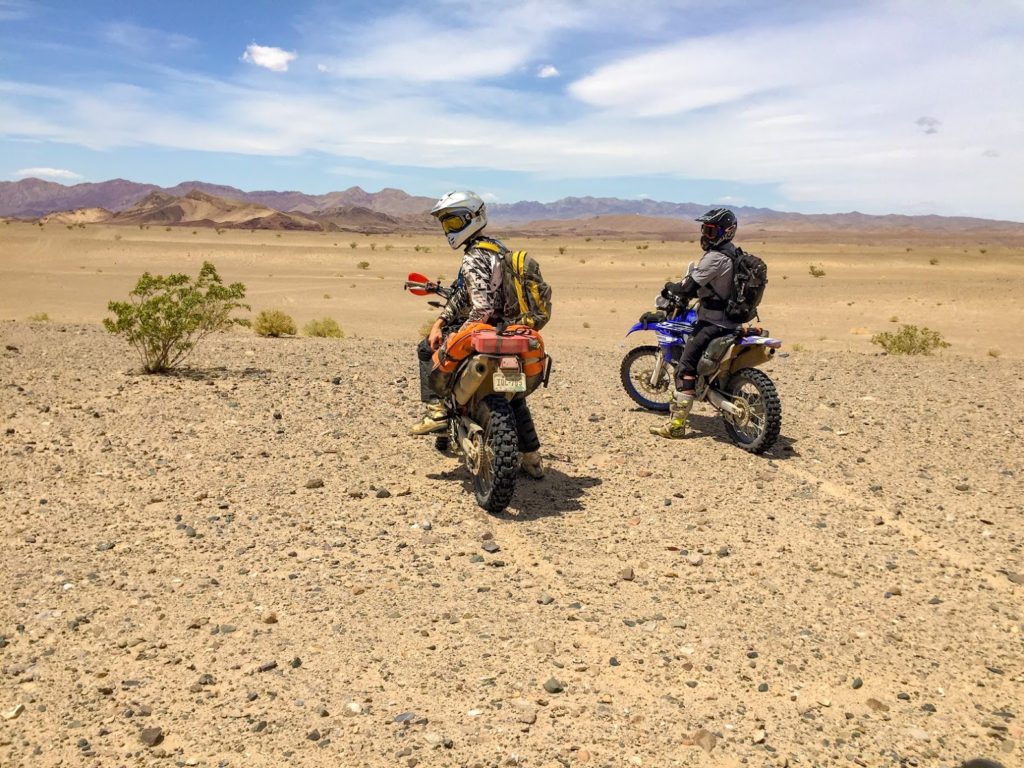
After topping out at the mine, we followed another transmission line service road skirting the Kingston Range Wilderness area. Turn-less for miles, this road snaked up and over various piles of rocks and shook our bodies to pieces with its brake chatter and camouflaged rocky obstacles. As we were merging back on the BDR, we noticed two other riders and stopped for a chat. By coincidence, they happened to be stopped at the entrance of a narrow route that threaded its way through the Kingston Range Wilderness Area bypassed by the BDR and arrived at the Dumont Dunes OHV area from the south. After a quick peek at the BLM map to confirm that the route was indeed open, we took the fortuitous left turn and managed an incredible upgrade. All of a sudden, we were transported back to Baja and replaced the BDR’s scenic paved road with sand, whoops, and adventures. A few hours later, the towering peaks of Dumont Dunes greeted us over the horizon.
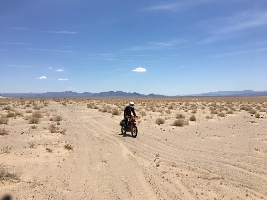
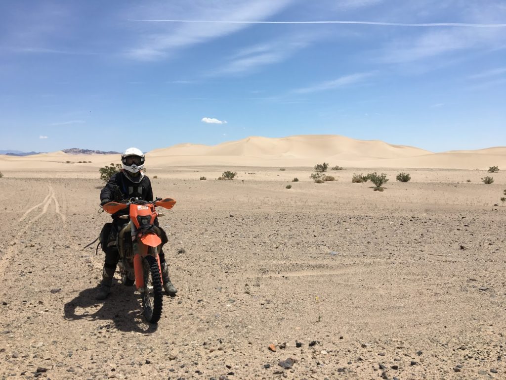
Left to right: the endless sandy transmission line service road; miles of sandy whoops took us to Dumont Dunes; the dunes themselves; on our way out
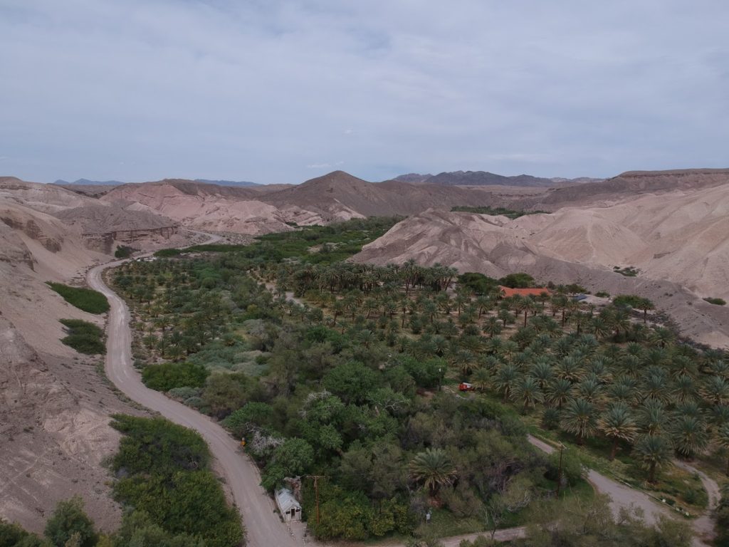
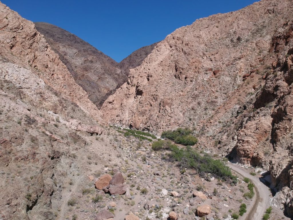
While the dune beckoned (Dumont Dunes is a major OHV area), the sun was high and we had 100+ miles to ride before Furnace Creek. We maneuvered through the tangled jeep roads surrounding the dunes and exited the park on the world’s toughest road leading to an official BLM Recreation Area (only later did we realize that the real entrance was a graded road a few miles west). We lunched at China Ranch, a lush oasis on which dates have been cultivated for 100 years, and entered Death Valley. In a National Park, alternative routes are few are far between, so we followed the BDR up West Side Rd., an unremarkable 40-mile-long graded dirt road that runs the length of the southern end of the park, to Furnace Creek, another oasis that served as our home for the night.
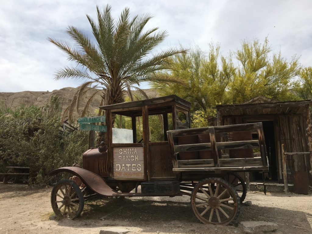
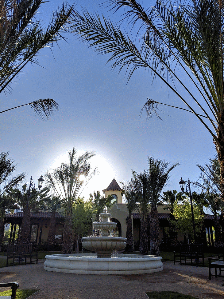
Top to bottom: The China Ranch oasis was a welcome relief from the sun and sand that had been punishing us all morning; Furnace Creek’s fountains and palms stood in sharp contrast to the suffocating heat of Death Valley; the sight of this valley would become quite familiar over the course of the trip
Day 4: Furnace Creek to Panamint or canyons for days
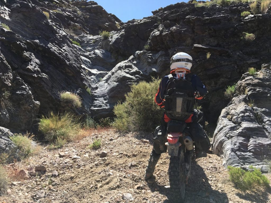
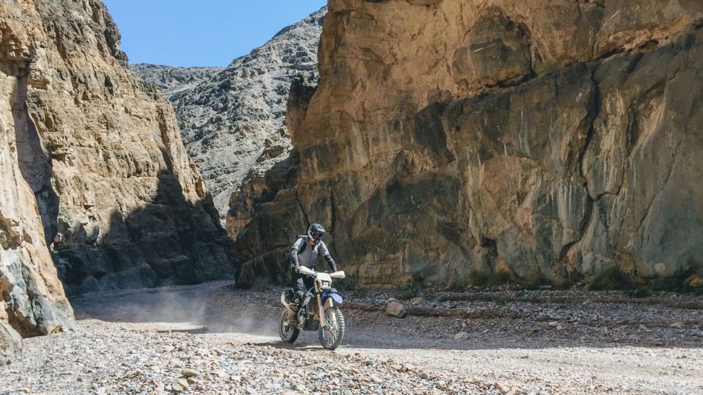
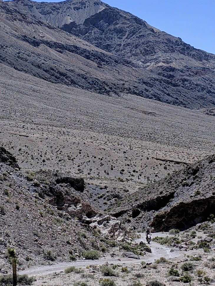
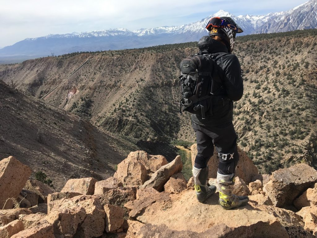
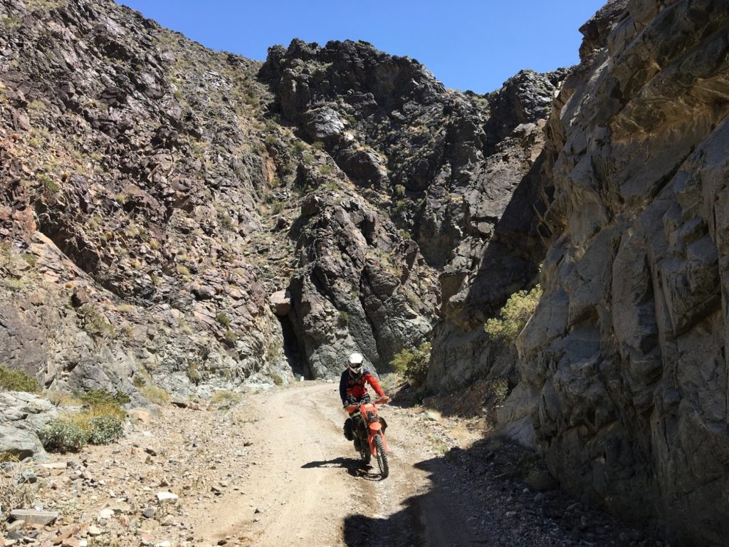
After a restful evening in Furnace Creek where we enjoyed vegetables the first time since the start of our trip, we escaped Death Valley through Echo Canyon. To many, Death Valley National Park is a bleached stretch of asphalt that connects Shoshone to Furnace Creek. To us, the park offered an incredible collection of tight canyons that crawled through the unforgiving mountains on each side. Echo Canyon would be our first of three.
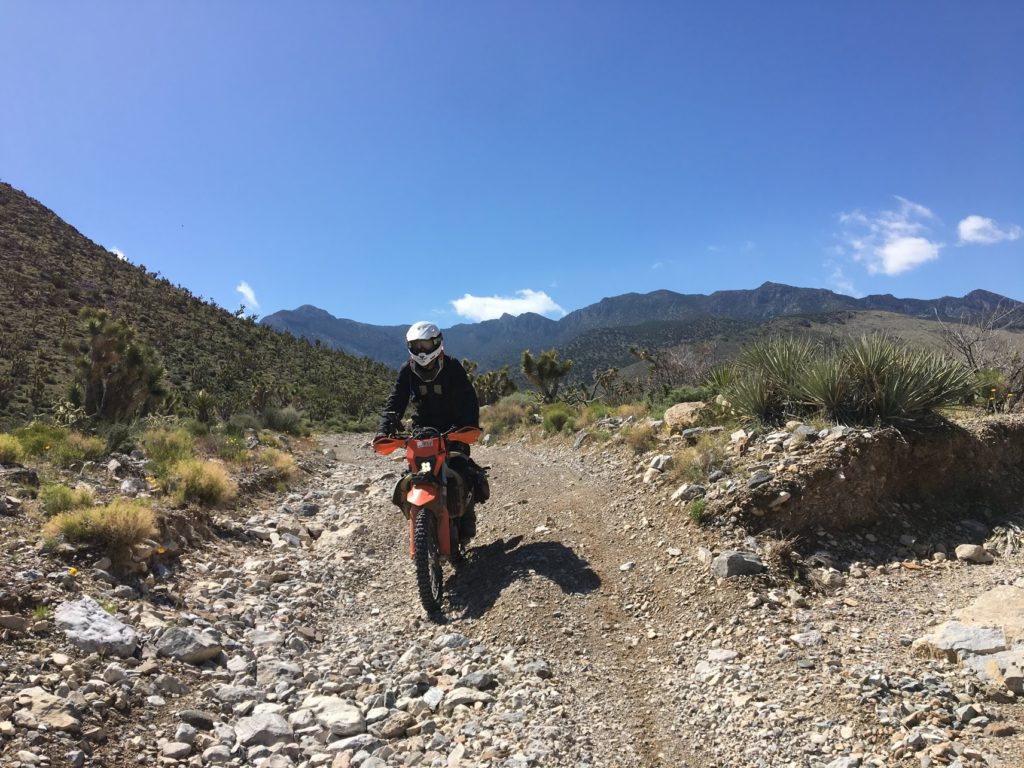
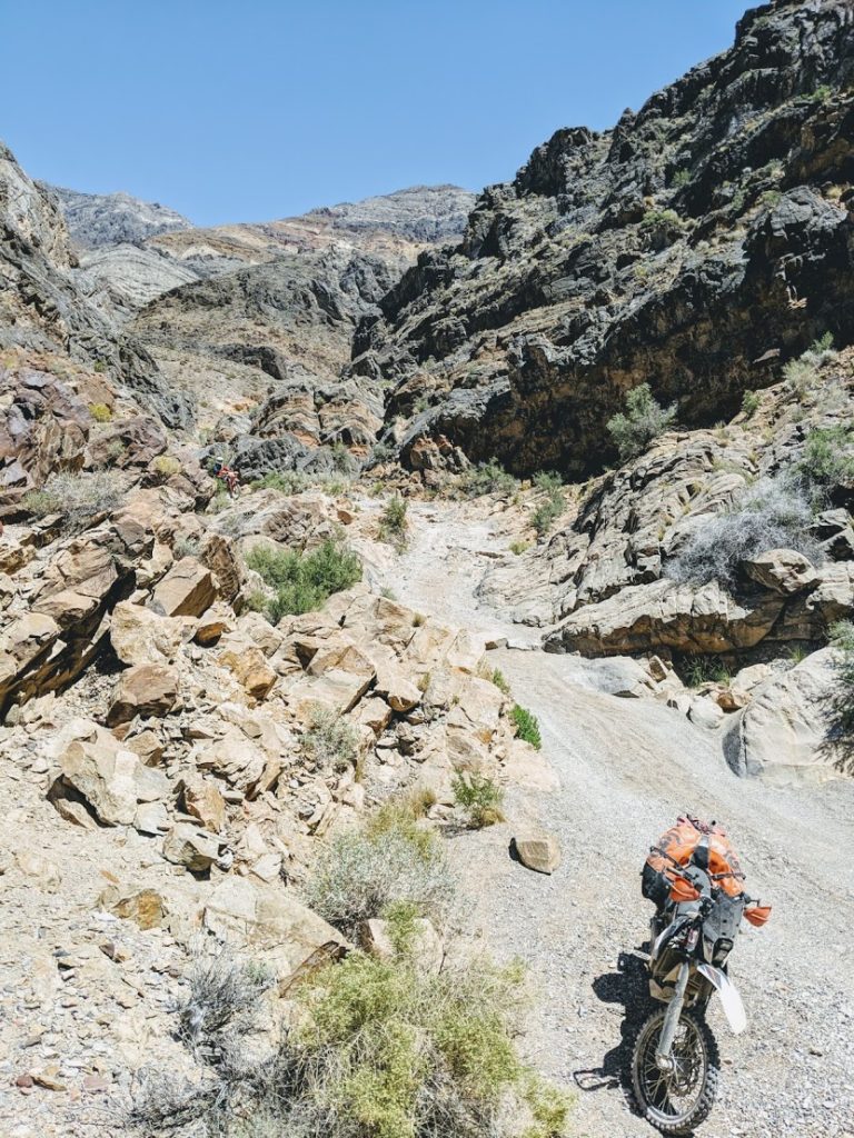
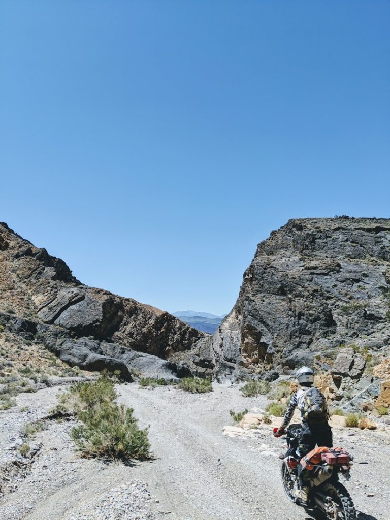
Echo Canyon began innocently enough as a wide gravel road that meandered its way between massive rock formations on either side. Quickly, the gravel turned to rock and fourth gear dropped to first. After visiting the abandoned Inyo Mine, we muscled our way over a few big boulders features, down a rocky descent, and into the maze of mining roads that would help us join the BDR.
All was going swimmingly as we floated over seas of babyheads, when BAM! Out of nowhere, my bike stopped and I did not. I haven’t crashed crashed in years. Yes, I have put the bike down in tough sections. Yes, I have gotten tired skiing through moguls and flopped over. But I cannot remember my last out-of-control crash. At some point in grad school, I decided that injuries just weren’t worth it, so I turned my riding down to 70% and haven’t gotten a scratch since then.
Until now. I sailed over my handlebars, saw the ground approach through my goggles, and belly flopped onto bed of sharp rocks. Never have I been so thankful for a full-faced helmet. Shaken up, I assessed the damage. I had scrapes all over my left wrist and a massively swollen right palm. I could move all of my fingers and I didn’t think I broke my wrist. Thank god. Twisting the throttle would be a challenge for the rest of the trip, but I had no choice. We were in the middle of nowhere. After a bit of poking and prodding, I diagnosed a thumb and wrist sprain. We plotted the easiest road out and headed toward Beatty for some medical supplies.
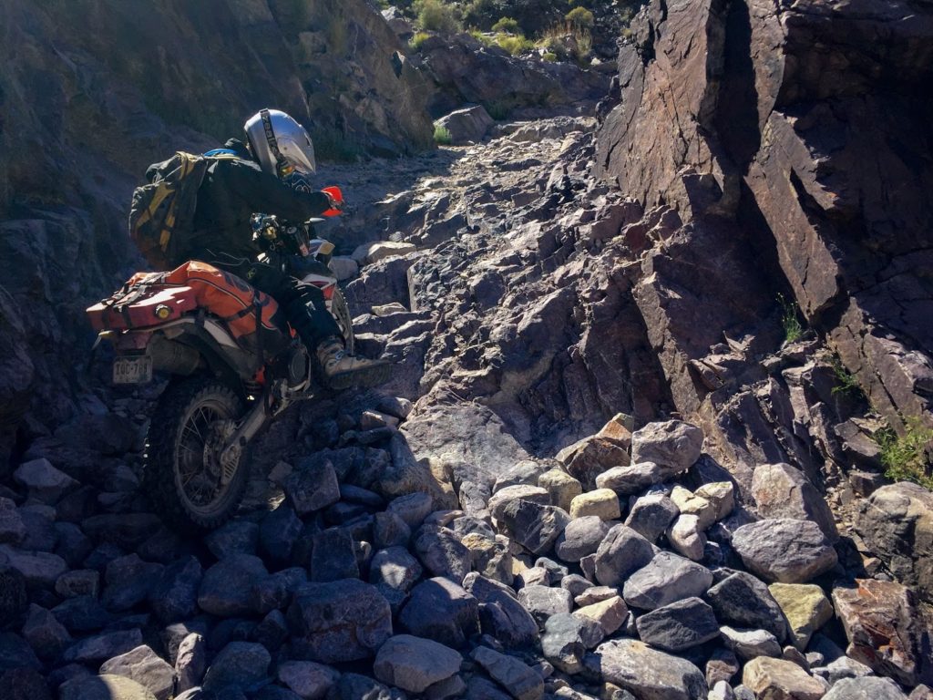
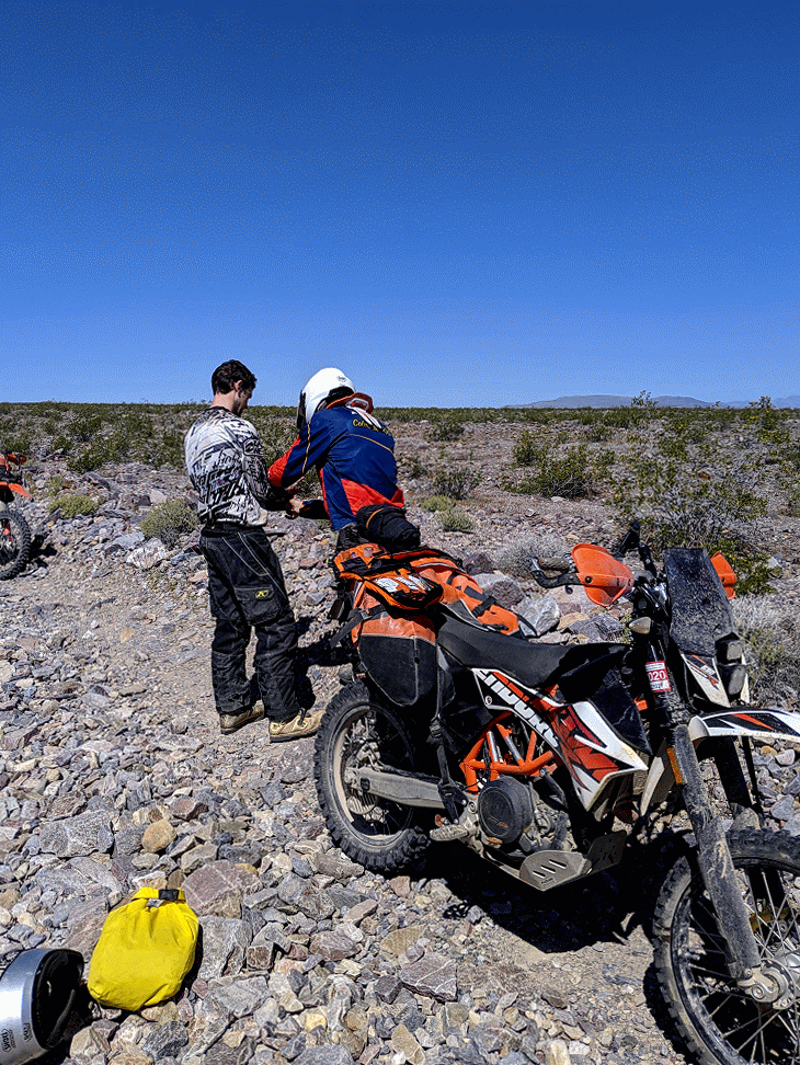
Left to right: entering Echo Canyon; beautiful scenery at Inyo mine; challenging step that keeps out the riff-raff; this one was a little too challenging; descending toward Beatty, inspecting the damage after the crash
On the way to Beatty, a massive dune emerged from behind the horizon. Big Dune, aptly named, is an open OHV area for for wannabe Lawrence of Arabias. My wrist was in no condition to explore the dunes, but Carl and Tom ripped up and down as I filmed with the little drone I brought along.
I also took the opportunity to reflect on the crash. Every other time I’ve gone down, I’ve been able to pinpoint what I did wrong. Too much speed. Not paying attention. Not enough gas. This time, the bike just seemed to stop. Inspecting the skid plate and rear shock mount, I saw a massive gouge into the aluminum. As best as I could tell, the front wheel must have flipped up one of the babyheads, which got lodged between another rock and the bike. This would have caused the bike to stop in its tracks and me to fly over the handlebars–a good reminder to all riders that no matter how much precaution you take to stay in control, accidents do happen!
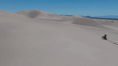
Big Dune is big!
After a quick stop in Beatty to clean my wounds and pick up some bandages, we followed the BDR down the famous Titus Canyon leg.
Titus Canyon delivered us back into Death Valley in a spectacular fashion
On the other side of Titus Canyon we were stopped in our tracks and not by the beauty of Death Valley. We were stopped by an unmistakable roar emanating from two F-35 fighter jets mock dogfighting just overhead. They climbed staight up, cut the power, stalled the planes into a leaf-like freefall, ripped the afterburners, and did it all over again. The aerial ballet was too much to ignore and we watch rapt until the pilots finished up with their fun.
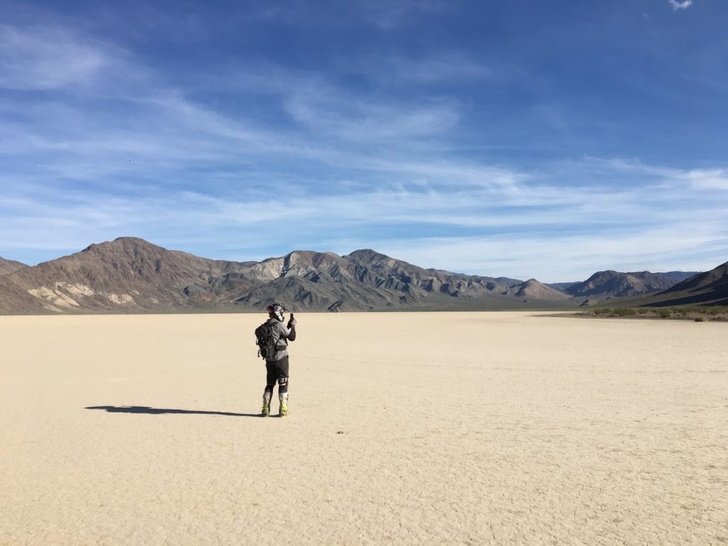
From Titus, we beelined the BDR for Panamint Springs. The day was a bit of a blur because we needed to cover a lot of miles that afternoon and I was worried about my wrist, but we see all of the standard Death Valley sight and the riding was fairly unremarkable. Ubehebe Crater is beautiful, the Racetrack is iconic, and Teakettle Junction is surprising. The two events to note were Carl’s inclusion in some Chinese tourists vacation album and the nasty descent (Lippincot Pass) into the Joshua Tree forest near Panamint. We dropped thousands of feet down a rocky, loose road cut into the side of a rusty mountain in just five miles. I was sure as heck glad we didn’t have to climb back up that one.
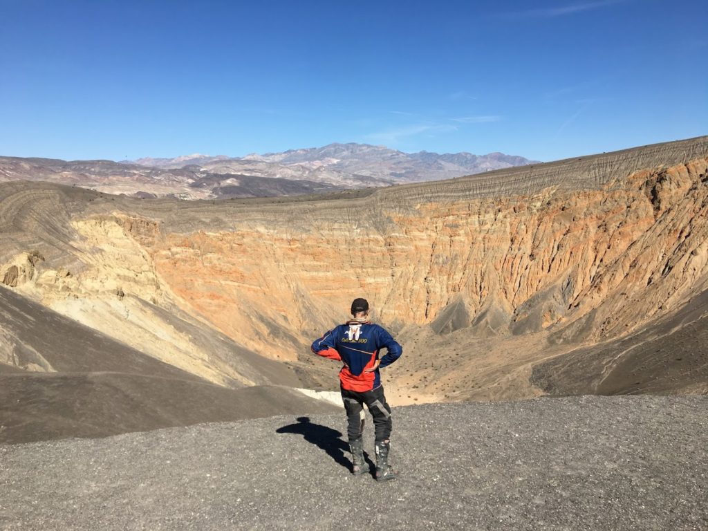
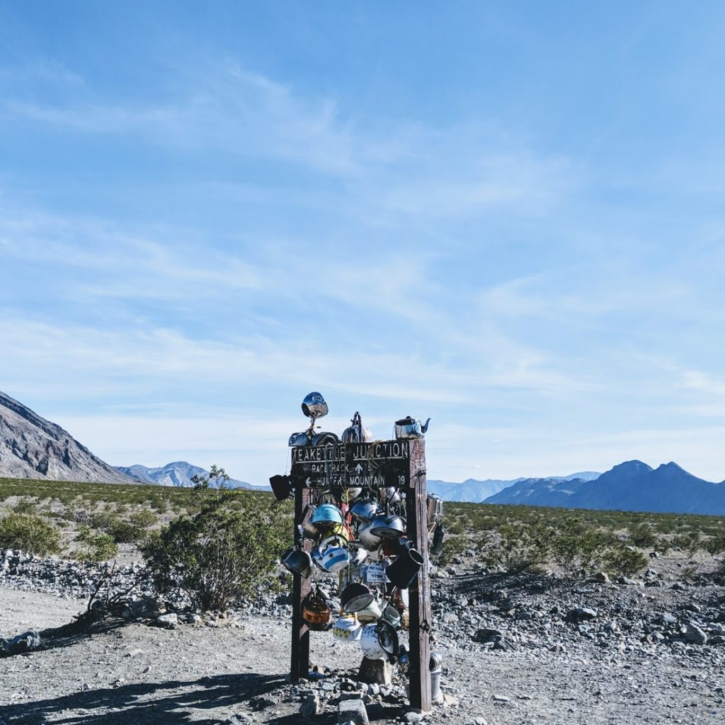
Left to right: Ubehebe Crater is quite the spectacle. Unfortunately, we didn’t have time to hike down.; Carl made it into a Chinese tourist’s highlights reel; The Racetrack is as cool as it’s made out to be.; Teakettle Junction; Halfway down the descent to hell; A quick look at the road. Pictures never do this loose stuff justice.
We arrived in Panamint exhausted. We had been on the bikes for nearly 11 hours, faced triple digit temperatures in Death Valley, nearly froze climbing into Panamint as the sun was setting, and were very much due for a beer, a shower, and a good night’s sleep.
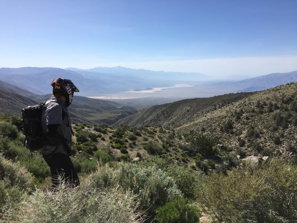
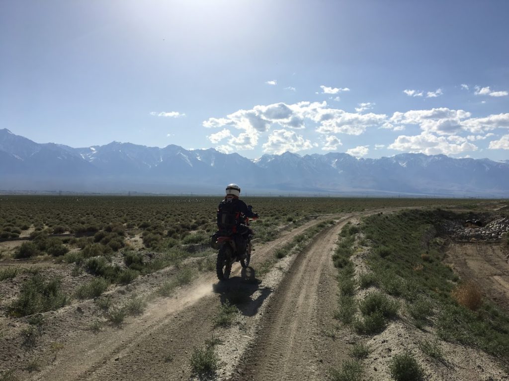
Day 5: Panamint to Bishop or the mountains are calling
The BDR calls for a route straight up Owen’s Valley to Bishop, but we thought we could do better by climbing up into the hill and through Eureka and Saline Dunes. We began by tracing our steps to the bottom of the prior day’s descent into hell when ROAR! An F-16 flew directly overhead less than 100 feet off the deck. ROAR! His wingman followed close behind. We watched as the two war machines dropped to the floor of Panamint Valley and disappeared into the distance.
Shortly thereafter, we stumbled upon the ruins of Saline Valley Salt Works, a seemingly ill-conceived business venture that involved harvesting extremely pure salt from Death Valley and hauling it over the Inyo Mountains via the steepest tram in America to Owens Valley. The operation continued in this desert for 17 years, bringing the best salt to markets like San Francisco and New York. After a bit of exploration, we did confirm both the presence of huge, pure salt crystals and the fact that none of us would ever like to work in that area. We packed some salt for the road and pointed our bikes toward Saline Springs.
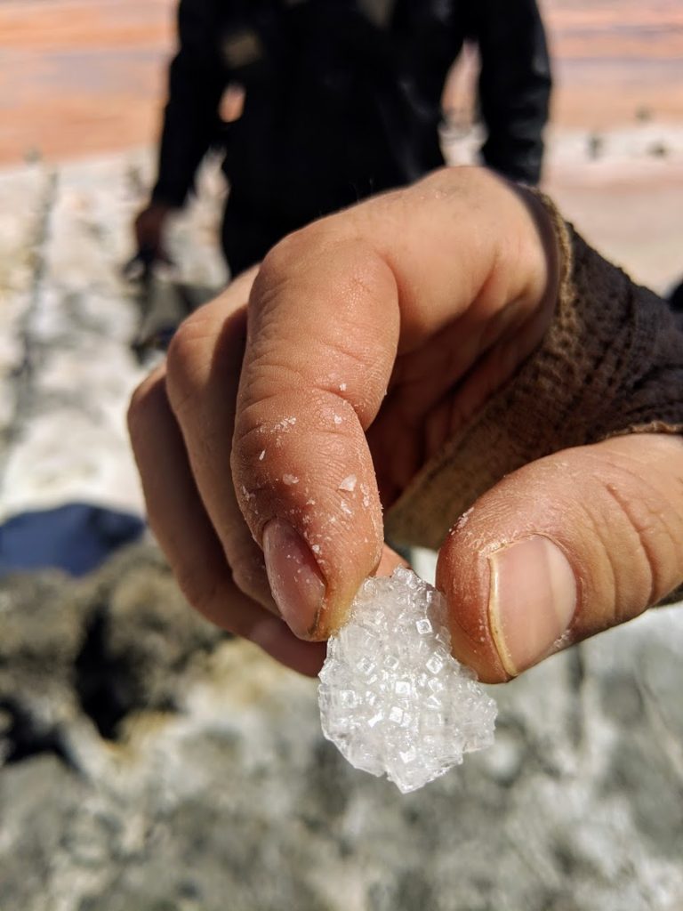
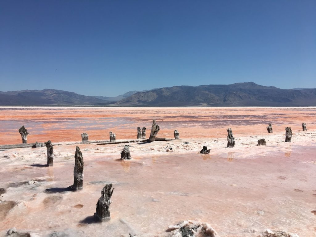
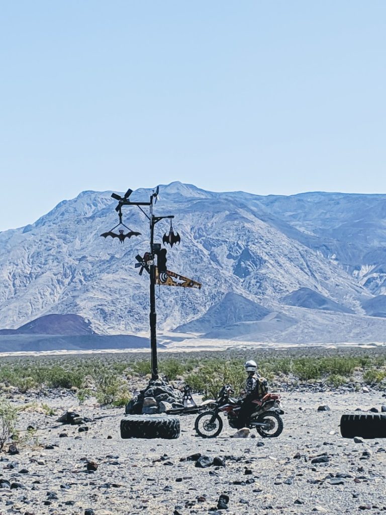
Left to right: view over Panamint Valley; pure salt from Saline Valley Salt Works; the salt works themselves; a bat sign near Saline Springs
Saline Springs is an interesting oasis where I would love to spend more time if it weren’t overrun with old nudists. The hot springs are surrounded by palms and lush grass, camping is allowed for 30 days, and the BLM maintains facilities. However, the presence of dozens of sagging, orange old men pushed us onward.
We hopped on a fun jeep road toward Lone Pine that wound its way through the mountains, through canyons, and within sight of the magnificent Eureka Dunes. Then disaster struck. While descending through the crux of the boulders, Tom’s bike died and refused to restart. If you recall from our Colorado-Utah trip that I finished solo, there is some precedent to this, but a dead bike where we were would be far worse than on a trafficked OHV trail. We were 100 miles from anywhere and none of us were excited about either towing or being towed.
On the bright side, the canyon leading down to Saline Dunes was the perfect place for the bike to die. I would have rather taken a cyanide pill than fixed a bike in the blazing, shelterless heat of Panamint Valley, so the cool, shaded canyon was a lucky break. After running through the standard diagnostics, we made three observations: 1) removing the fuel filter between the tank and the injector helped the bike nearly start, 2) the fuel splashed violently around in the tank when the engine was running, and 3) the engine would start but not idle when the choke was applied. I’ll leave it to my reader to guess what was wrong until I reveal it a few paragraphs below.
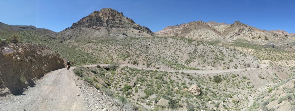
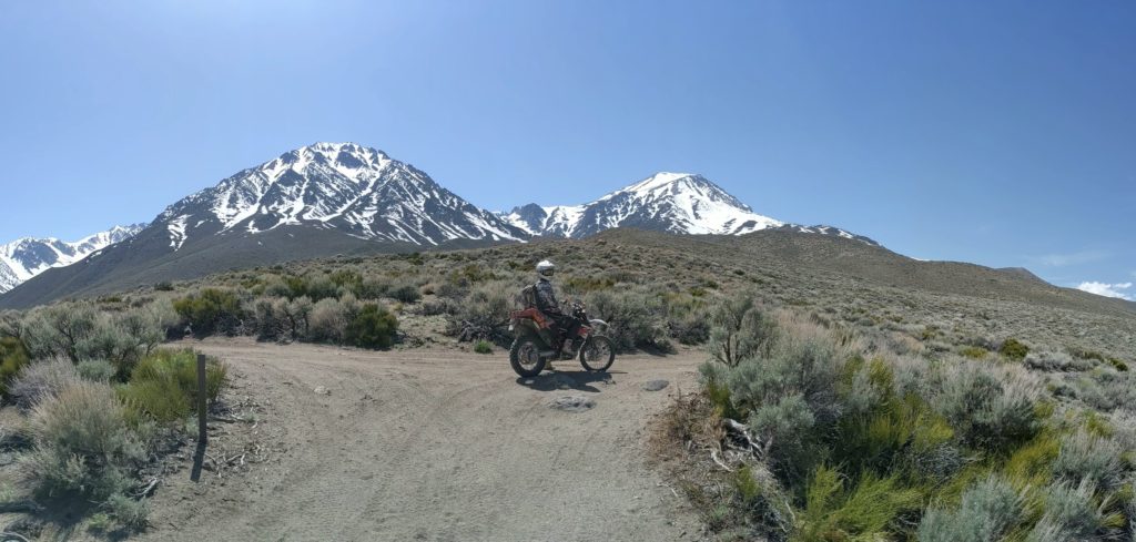
We were able to get the bike running again, but we wanted to try to get it to a shop in Bishop before the end of the business day. With speed in mind, we cruised the graded road to Highway 395, where we got our first glimpse of the Eastern Sierras and Tom turned north. Carl and I spent the afternoon tinkering around on sandy jeep roads paralleling the main highway, sneaking peeks at the Caltech radio telescopes, and scoping out Poleta Open Area, Bishop’s OHV paradise.
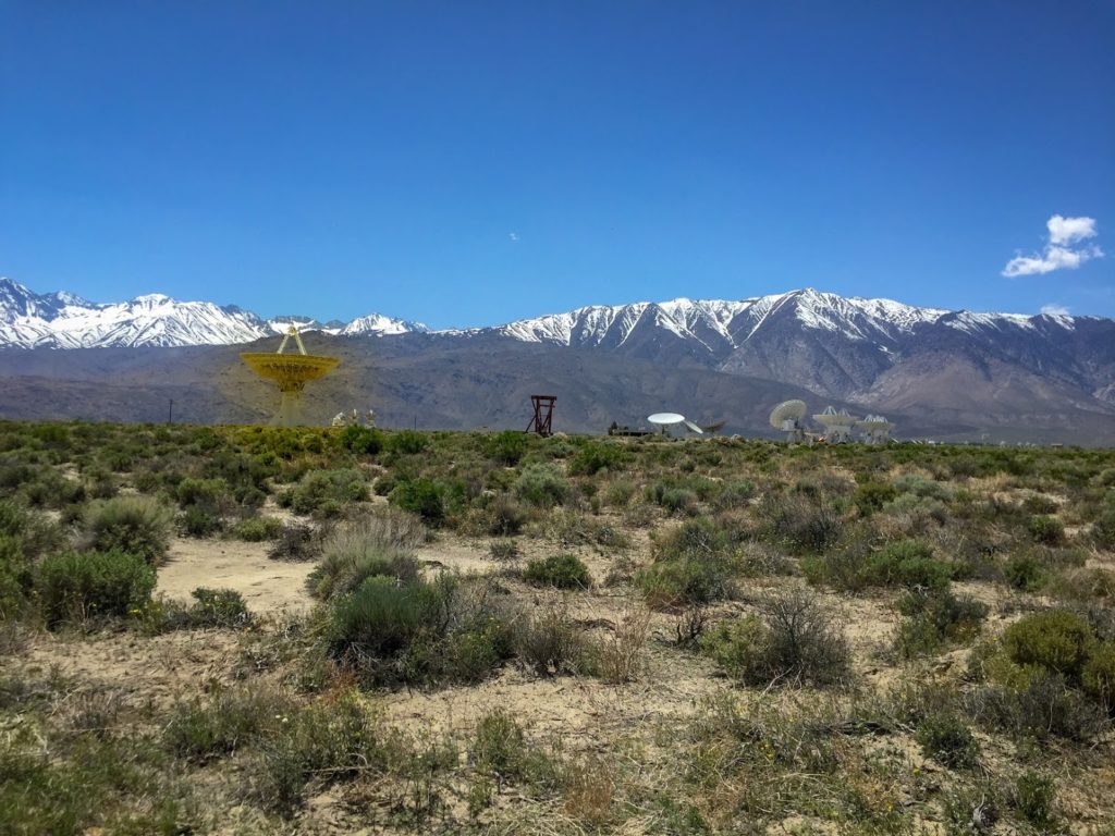
Left to right: the Eastern Sierras are breathtaking. The first time they appeared, we knew we had done something right.; Caltech built an interesting radio telescope array along the wash from Big Pine to Bishop.; mountains + wash = good
Day 6: Bishop to Lone Pine or I want to buy a ranch in Owens Valley
Chad Banta Repairs took Tom’s bike in the previous day, but was booked until the morning of Day 6. Carl and I considered riding up to Mammoth and strapping on some skis for the morning, but reconsidered and plotted out a route recommended by the local trail riders association. We cruised up Casa Diablo Road to the start of the Mammoth Lakes trail system and bounced our way through fun double track until we encountered the banks of Crowley Lake. Happy to hear from Tom that the bike had been repaired, we grabbed a quick snack at Tom’s Place Resort (unrelated) and fired back on the road.
Miles of fun double track await below Mammoth; A giant canyon stood between us and Crowley Lake, which explained the lack of a direct route
Did any of my dear readers guess what was wrong with Tom’s bike? Our hypothesis in the canyon turned out to be nearly true. We believe that something inside the fuel pump has become disconnected and some of the pressure generated by the fuel pump was going toward creating turbulence in the tank rather than supplying the injector. It turned out that the fuel filter inside the pump had cracked and Chad Banta just happened to be a KTM guy and had a spare. Lucky break.
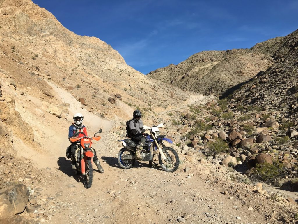
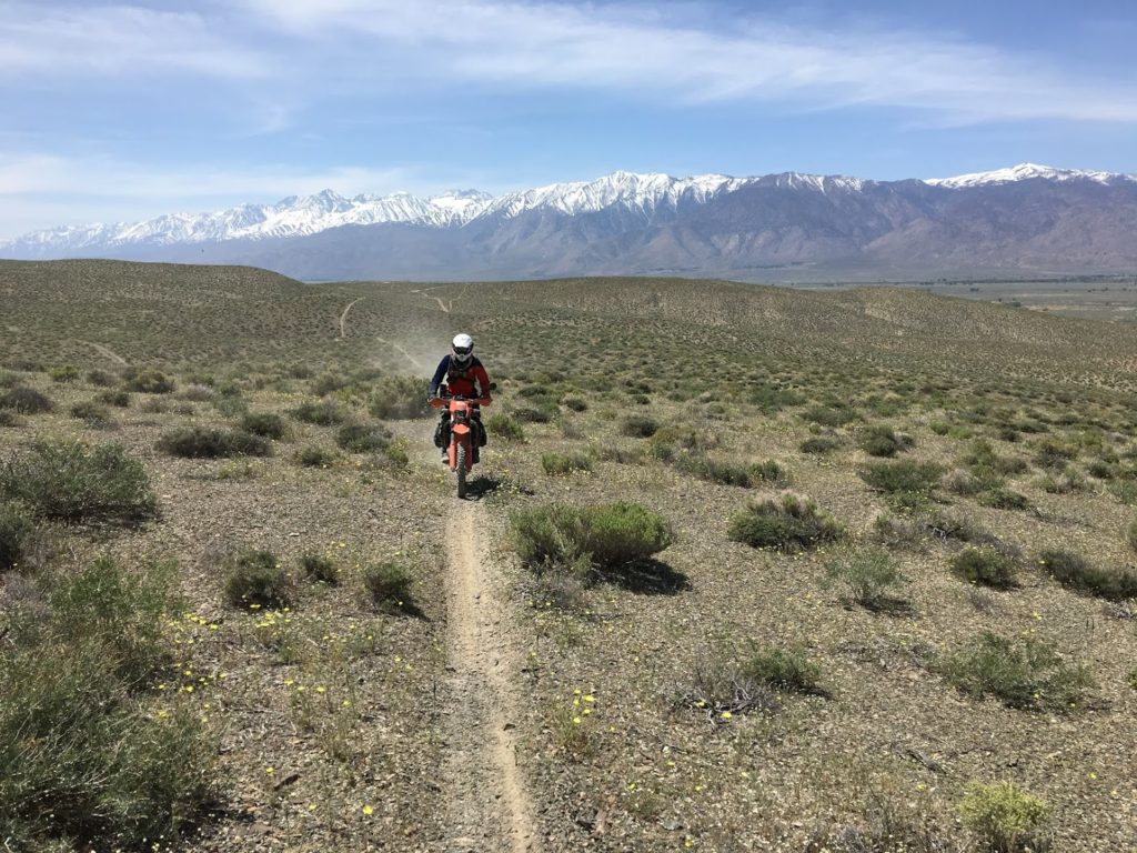
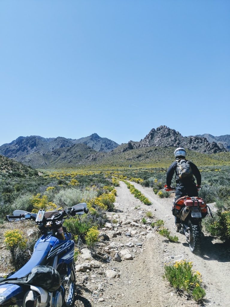
The three musketeers set off toward Lone Pine by way of the Poleta Open Area. We followed many miles of spectacular single track cut in the shadow of the Eastern Sierras and a variant of the BDR that took us higher into the mountains, and eventually reunited with the BDR itself.
Poleta Open Area is full of A+ single track; It didn’t get a great picture of our adventures in the foothills, but take my word that the scenery was breathtaking
From Big Pine to Lone Pine, the BDR follows an irrigation ditch through the Owen’s Valley (the one made famous by Chinatown?) and cuts through Manzanar, a former Japanese internment camp to Alabama Hills. Again, my photography skills failed to capture the beautify of an area, but please do visit the Alabama Hills. They are littered with alien boulders and sweeping views of Mt. Whitney and the environs.
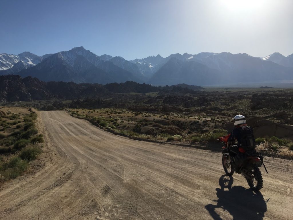
We followed an irrigation ditch through the Owen’s Valley for quite some time. I need to watch Chinatown to see if I bore witness to the disgrace responsible Los Angeles’ growth.; Alabama Hills is one of the most beautiful places on the planet. This picture does not do it justice. You can see the summit of Mt. Whitney, the continental US’s highest peak, in the background of this photo.
Day 7: Lone Pine to Shoshone or 200+ miles off-road makes me tired
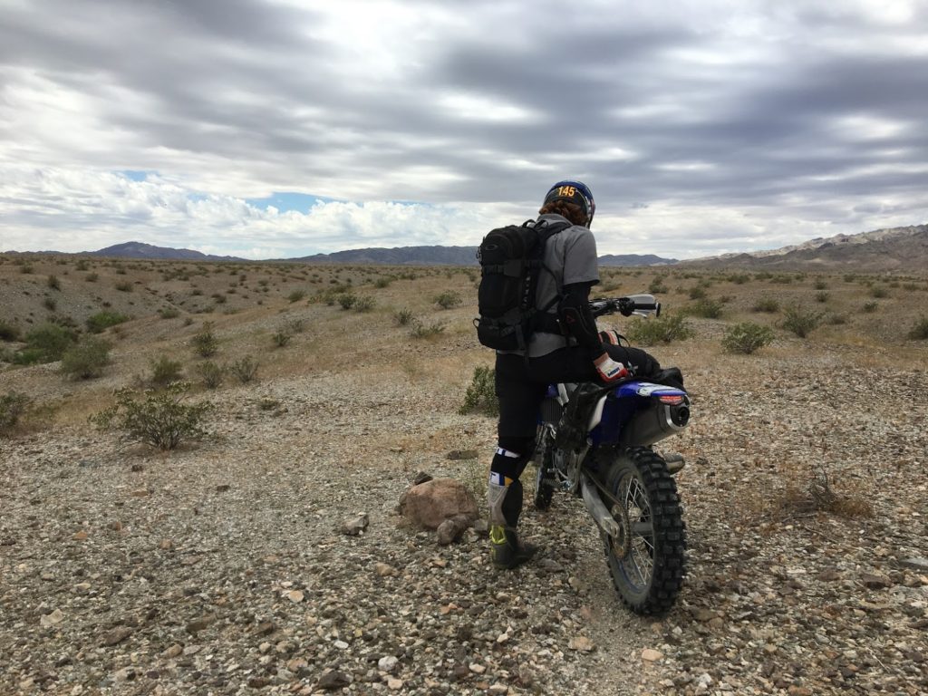
The residual fatigue, awareness that we were officially retracing our steps, and knowledge that we would be crushing more than 200 miles of trail through Death Valley weighed heavily on us as we left Lone Pine. Gone would be the beautiful vistas and cool air of the Eastern Sierras. We were headed back to the hell of Death Valley, where the air is thicker than any other on earth and the interminable wind evokes convection oven rather than seaside breeze.
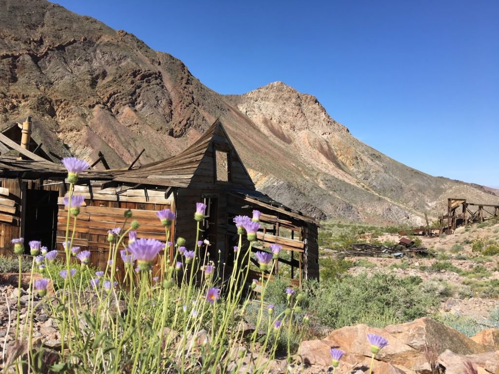
We didn’t stop to take a single picture in the morning. The temperatures were nearing the triple digits, shelter was scarce, and we knew we had a long way to go. Our route followed the BDR up and over Cerro Gordo Peak and took a quick detour through the ghost town of Darwin, which is well worth a visit if you are in the area. While the town clearly has a few permanent residents hiding from the sweltering heat in their bleached RVs, the vast majority of this once grand mining colony has been totally abandoned. Of all of the ghost towns we encountered on this trip, Darwin stands out to me as the one that I wish I had more time to explore.
Out of Darwin, we descended to Panamint via a narrow wash. I wanted to stop for lunch, but my pleas went unheeded. We pushed south through Panamint Valley on the road from hell. Nothing about this section was particularly hard, but the sun was blazing and progress was slow. Every time we were able to shift out of third and get some airflow moving over our bodies and the bikes, a giant wash would appear and force us to downshift and pick through a field of boulders. Fortunately, after many miles, our road merged with a once-paved transmission line access rode and we buzzed into Ballarat.
Ballarat is marked as a ghost town on both the BDR and Park Service map, but it is certainly not uninhabited. I have no idea how or why people live in the unforgiving Panamint Valley, but abandoned mining buildings were greatly outnumbered by battered RVs and single-wide trailers. A pair of characters even resurrected the Ballarat Trading post and offered us some cold beers. Upon our refusal, they figured that we were the hard liquor type and tried to push some moonshine our way. After a little bit of negotiation, we were able to order virgin cold Coca-Colas and enjoy the cooling shade for a few minutes before making our way back over the mountains and into Death Valley.
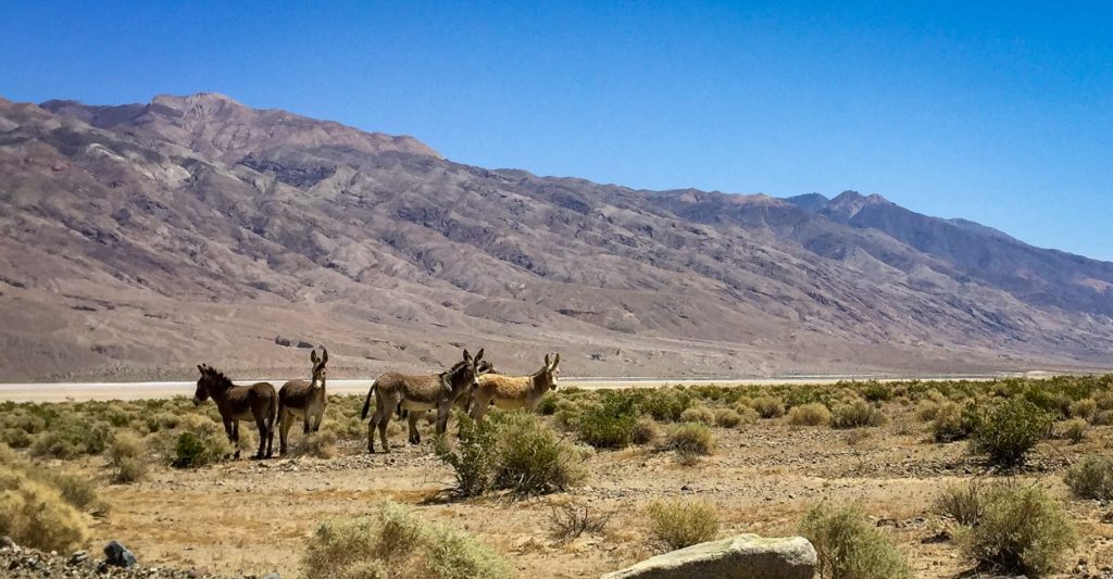
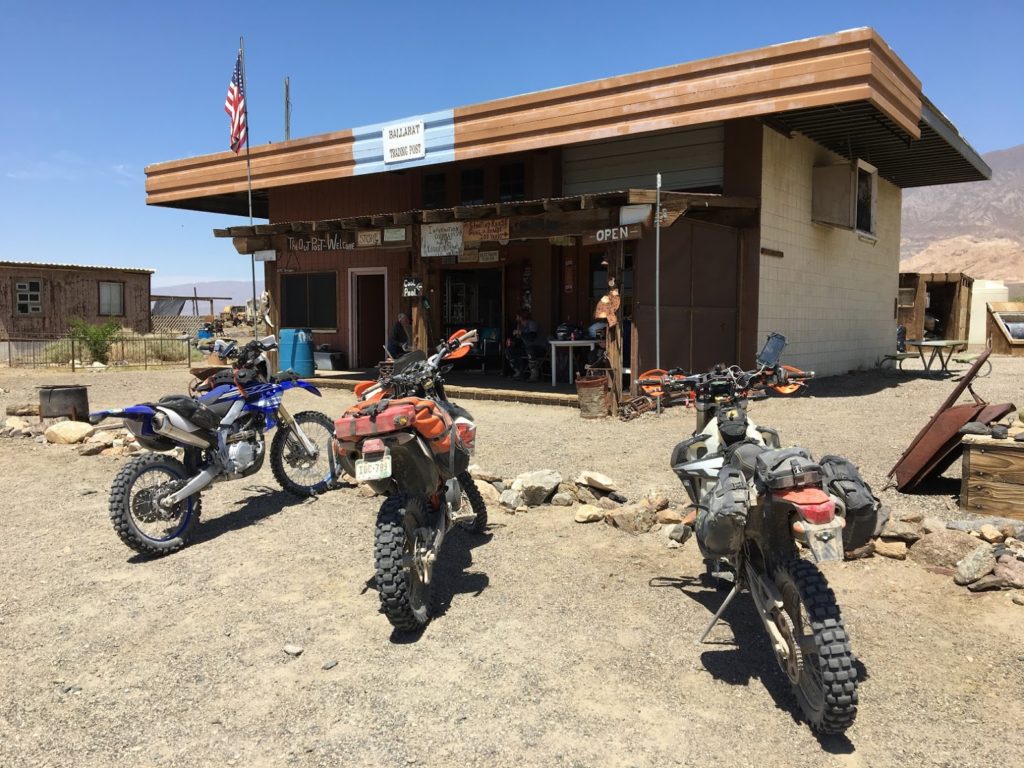
Left: I have no idea how these wild Burros survive in Panamint Valley. Right: The Ballarat Trading Post has been resurrected by a couple of colorful characters who offer cold(ish) Busch Light, moonshine, and Coca-Cola.
Death Valley National Park is huge. The primary road through Death Valley itself represents a tiny fraction of the park’s 3.4 million acres. The main attraction for off-road enthusiasts is the network of tight canyons that traverse the rusted mountains that surround the valley to the east and west. We had previously climbed out of Death Valley via Echo Canyon and returned via Titus Canyon, but would make the trip one last time through Goler Canyon.
Unlike our previous two crossings, it was not at all obvious how Goler Canyon would get us out of Panamint Valley. The rocky hills to the east seems impenetrable to even a hiker, but sure enough a thin road emerged behind a slab of rock. Immediately after entering Goler, the temperature dropped and the fun ramped. A babbling brook even began trickling down the road.
Goler Canyon led us back into Death Valley.
After summiting Goler, we began the long descent into Shoshone. We followed the sandy Warm Springs Road into Death Valley, retraced our steps through the park, and finished with a pointless BDR detour into Shoshone.

A bit of green rewarded us for the climb out of Panamint. Shortly thereafter, we would descend back into the furnace.
Day 8: Shoshone to Niption or how we almost grabbed the podium in a desert race
The final day was a short one. I had a flight out of Las Vegas in the afternoon and we were all beat. Instead of taking every opportunity to explore, we stoically followed the BDR back to Nipton. No lunch. No breaks. No conversation. The three of us fell into a zen-like state listening to the engines hum as we made our way back home.
Once the BDR terminated in Primm, we plotted our course through town to a piece of trail that paralleled the railroad tracks and would land us back in Nipton. To our great fortune, a pro-level desert race was running that day and we had 15 minutes to hustle through before the gun would go off. On another day, we would have waited around a corner until right before the racers arrived and gotten a photo of us riding our touring bikes in the pole position, but the desert had taken it out of all of us.
We rode the sand along the tracks all the way back to Nipton, stripped off our battered gear, ordered a few ales at our favorite Whistlestop Cafe, clinked our glasses, and called it another successful trip.
Gorgeous wildflowers were blooming alongside the BDR route that we had previously passed up in favor of the whoops to Dumont Dunes; One final vista of Ivanpah.