Edit: Since writing this, I have posted a number of other dual-sport adventures including exploring Death Valley, looping the Grand Canyon, becoming a rally racer in Baja, and connecting the best moto route through Colorado and Utah.
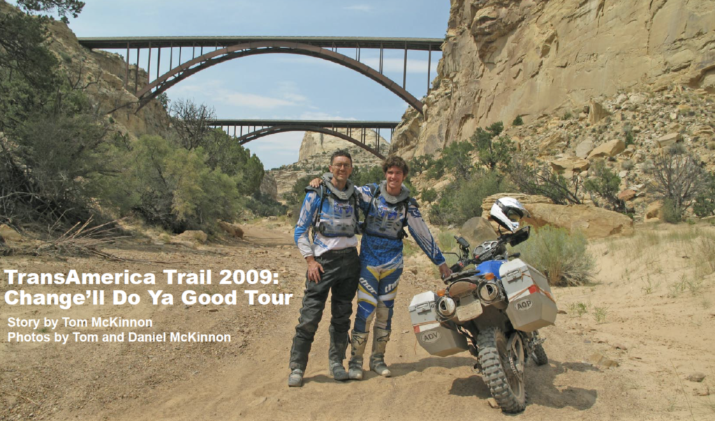
After writing up my tour of Jalisco blog post, I was reminded of the article my dad wrote about our journey across the country on the Transamerica Trail. Download the Adventure Motorcycle magazine article here or give it a read below.
TL;DR: Between college and graduate school my dad and I rode a few thousand miles off-road between Colorado and Oregon on the Transamerica Trail. It was the experience of a lifetime that I would highly recommend to any motorcycle enthusiast.
Sometimes life’s changes just hit us and sometimes we make them happen. For Daniel and me, it was a combination of both. And to paraphrase, an upheaval is a terrible thing to waste. I had just ditched my university job after nearly twenty years spent filling the noggins of fledgling engineers with notions of chemistry and thermodynamics. I was lured by the entrepreneurial siren song to abandon the most secure job on the planet.
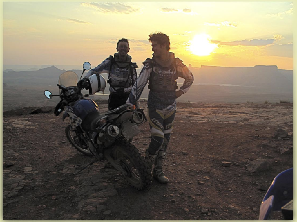
Daniel, my 23-year old-son, was a newly minted college grad about to mount the next rung of the ladder of academia at UC Santa Barbara. With both father and son at major life crossroads, what better way to experience the transitions than enroll in the College of Backroad Adventure. So last September, we pointed our dual sports westward from Boulder, Colorado toward the waters of the Pacific. Daniel was piloting El Puerco, an ’03 BMW F650 Dakar, and I was astride La Poderosa, a brand spankin’ new ’09 Yamaha WR250R.
Daniel and I were pumped for adventure, except for one minor issue: the course prerequisites. As a child of Boulder, Daniel was practically born riding mountain bikes over impossibly gnarly terrain. Needless to say, he took to dirt biking like a duck to a June bug. I, on the other hand, had first swung my leg over a moto only a few months prior and had logged a scant number of hours in the saddle. With Don Quixote riding pillion, I was jonesin’ to tilt at some windmills.
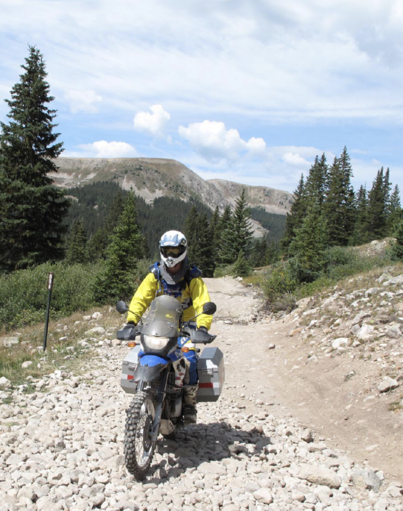
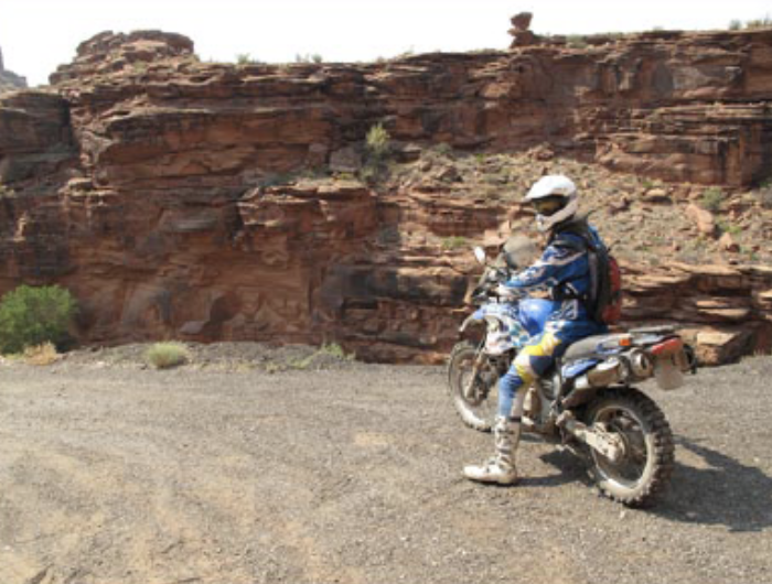
Our route was the Trans America Trail (TAT), a path pioneered by the retired Mississippi pharmacist Sam Correro. Sam’s prime directive was to ride coast-to coast without the benefit of tarmac. After over a decade of hard work, map-gazing, and an un- countable number of worn-out knobbies, Sam stitched a rag-tag collection of “thin lines on the map” ranging from graded Forest Service roads to sagebrush double track in the high desert. His final product links Jellico, Tennessee to Port Orford, Oregon. Finding a pavement-free corridor clear to the Atlantic was elusive but he got pretty darn close. In order to meet our prime directive of getting Daniel to Santa Barbara in 16 days we had to forgo the eastern section of the TAT. Instead we planned to pick up Sam’s brainchild at its halfway point in Salida, Colorado, a town where cowboys and yoga instructors rub elbows over morning coffee.
Rubbing sleep out of my eyes in my Salida hostel bunk, I can’t exorcise gut-wrenching words from my head: Hancock and Tomichi. Passes, that is. “You won’t make it. I turned back a mile short of Tomichi and was glad I did,” Karst, a tough adventure biker, told me recently. Daniel, ever the fearless buck, retorts with a casual “I’m not worried.” OK, I may not have the bike-handling skills of The Young Turk, but if he can get his big slab of German iron over those passes I’m damn well gonna’ follow on my svelte Japanese machine. Sam provides for a big-bike detour to avoid these passes but his inclusion of the alternate route ratcheted up my apprehension level.
Rolling through the verdant alfalfa fields of Salida’s Arkansas River Valley, we pass the ghost glad town of St. Elmo, where fortunes in gold were extracted in its day. The road roughens and the altitude becomes a barometer of my anxiety. As the trees fall behind us, I can see Hancock Pass. It doesn’t look too bad so we head onward and upward. The trail is bumpy, loose, and off-camber, but finally achieving Hancock is a profoundly empowering experience. “If I can handle this, I can handle anything on the TAT,” I think confidently. The route to Tomichi features a road full of grapefruit size obstacles, instead of Hancock’s loose shale, but I keep the rubber side down clear to the top.
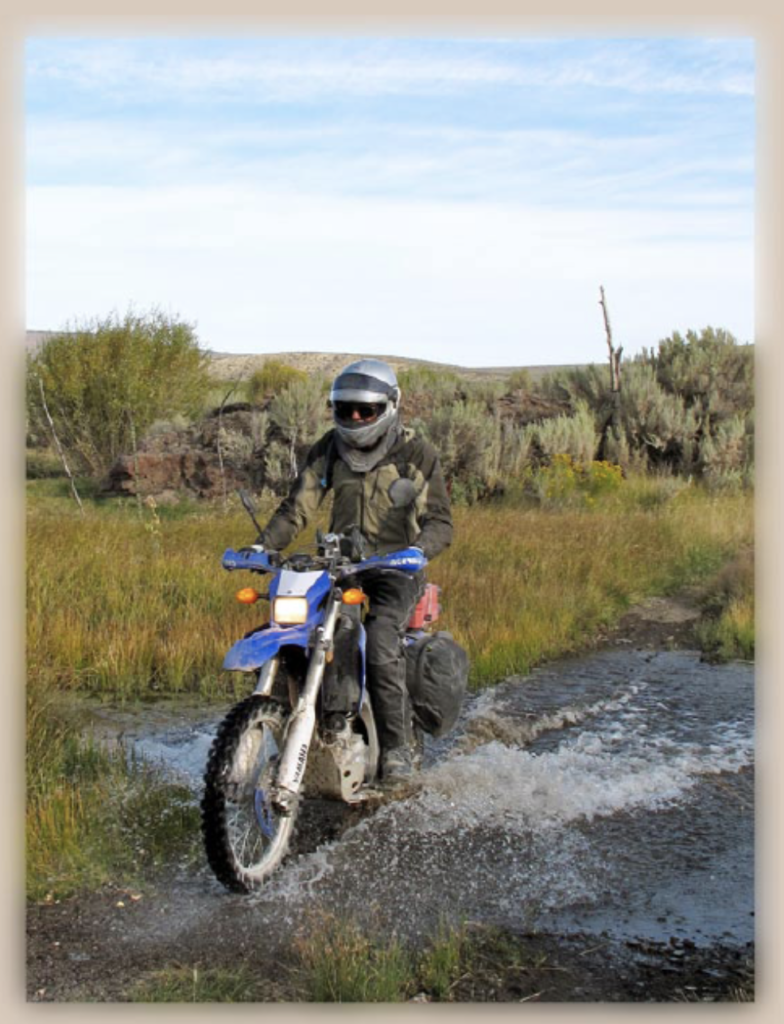
Our lunch destination was Lake City, Colorado, a town launched into infamy by Alferd Packer, the only American ever convicted of cannibalism. There, Alferd devised his own meal plan while snow-bound with his mates in the spring of 1874. At his trial, the judge reportedly spat “Alferd, they’s only seven Dimmycrats in Hinsdale and you done et five of ’em.” Over lunch, (vegetarian!), some fellow bikers suggest that we swap out Cinnamon Pass, the official TAT route, in favor of Engineer Pass. While the 12,800-foot Engineer Pass would be tough on a big bike, it will afford some of the most magnificent mountain vistas of the entire journey. Downing backside of Engineer, with sunlight failing, I misjudge some rock ledges on a sharp right turn. Suddenly flattened under a horizontal Yamaha – in the middle of the road – on a blind corner – with a swarm of Jeeps closing fast from behind – I panic. Laying on my feeble Japanese horn and struggling mightily with my trapped leg, I prepare for the worst.
Fortunately the moto gods are smiling as the Jeepers stop in time and lend a little muscle to get me vertical again. After some minor wrenching, we are back on the road to Ouray for the evening. Aptly known as the Switzerland of America, Ouray has shifted from mining gold in the mountains to mining gold from the pockets of the legions of ice climbers who descend upon the town all winter. While just our first day on the TAT, this one will go down in the books as a died-and-gone-to-heaven day in the saddle.
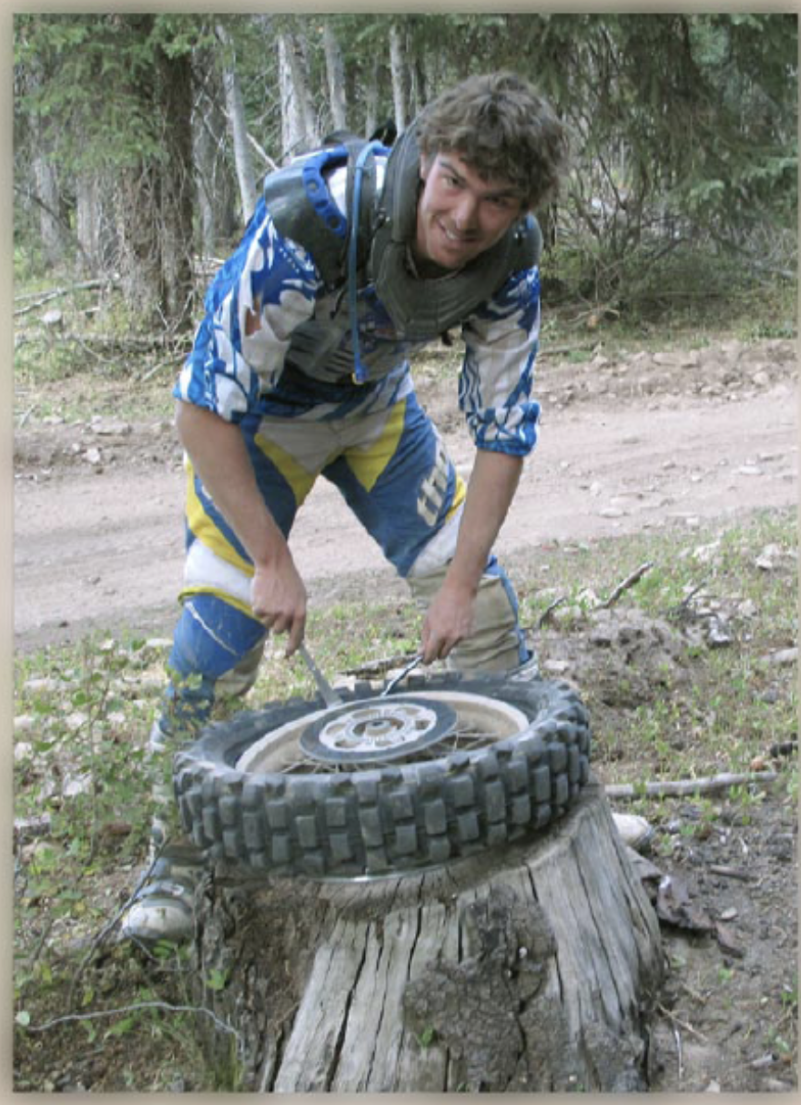
One course requirement for the TAT is the ability to McGyver one’s way out of whatever situation that might come along. On Day 3, our homework is assigned when Daniel’s right pannier flies from its moorings on a section of the trail marked on Sam’s roll charts as “Fun, fun, fun.”
I suggest to Daniel that he slow down a teensy, weensy little bit while launching over rocks and ledges but it falls on deaf ears. Luckily, a bolt in our random-parts bag, after some makeshift trailside blacksmithing, completed the homework with high marks. An unavoidable consequence of Sam’s prime directive was that the TAT sometimes follows flatland county roads that don’t really peak the fun-o-meter. Descending from the mountains of Colorado toward Utah we are beset by such a stretch and commit the ultimate TAT heresy: a pavement detour. When passing the “Welcome to Utah” road sign, one of us war-hoots loud enough to be heard all the way back to the Boulder County Courthouse.
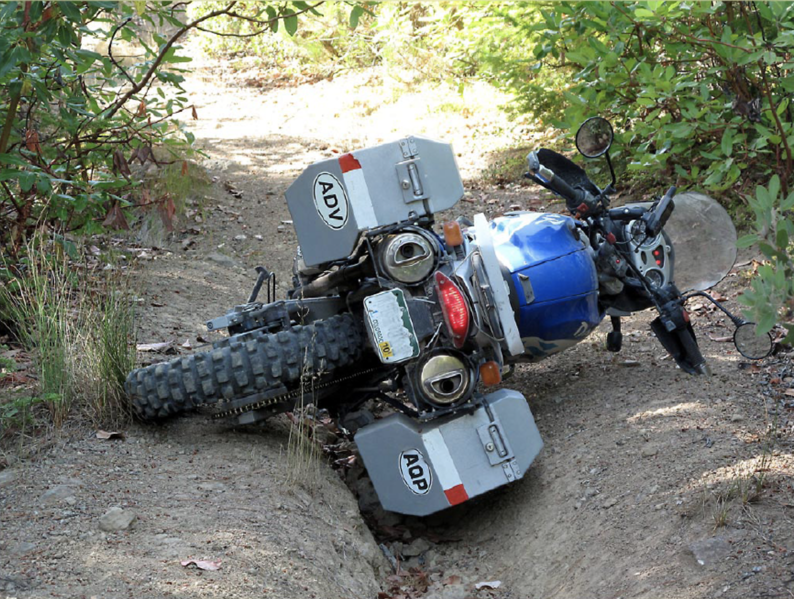
Having scored some free lodging from a friend in Moab, Utah, we loiter an extra day to enjoy its famed terrain of slick rock and towering rock obelisks. Moab, with an odd juxtaposition of rednecks on quads, mountain bikers, dirt bikers, and Desert Solitaire eco-nazis, miraculously seems to avoid coming apart at the seams. In the morning we scoot off to a pizza oven also known as the Moab desert to enroll in Fundamental Principles of Sand Riding 101 featuring the basics: (1) up on the pegs, (2) weight rearwards to float the front wheel, (3) lay on the throttle, and (4) have huge cojones. I can’t say it’s pretty, but when all the stars align, sand riding is a kick. Buoyed with premature confidence, I crash pretty hard on some rock ledges heading back to town. Needless to say, big rocks are less forgiving than sand, but a drugstore brace re-enables my wrist for riding.
If the run from Salida to Ouray was best so far, the trek out of Moab comes in a close second. The terrain around Moab is known for its natural bridges, improbable arcs of rock over long-since-gone river runs and more. The TAT skirts Arches National Monument, which is chock full of them, and passes several bridges on the northerly desert run to Green River, Utah.
Shortly out of Green River, the TAT threads into the Black Dragon Canyon, a sandstone gateway to the San Rafael Swell. The canyon, whose moniker comes from the Freemont Indian pictographs that line its walls, shields us from the blistering heat by overhanging cliffs reaching skyward over a thousand feet. Traversing the canyon previews what we would ride upon all day – a challenging mix of loose sand and pavement-like slick rock. As it turns out, Advanced Sandology 201 – deeper, looser, longer – stretches us beyond our limits. Deep in a wash I hear Daniel cursing a blue streak with El Puerco proudly pinning him down in the sand. Although I was only about 50 yards behind, it was a tossup whether the speediest way to lend aid was by thrashing around in the grit on my bike or dropping it and advancing on foot. We didn’t earn passing marks for this rigorous course but promise to re-enroll.
The voyage so far had exceeded all my expectations, yet on Day 4, out of Richfield, Utah, our number again was up – time for a little more yin with our yang. Our first trouble began with the GPS guiding us past a decidedly unfriendly No Trespassing sign. No problem, just a slight detour; the Black Diamond trail marker should have tipped us off, but no. This Trail of No Return plunges through rocks and ruts with scrub oak encroaching both sides. Daniel, his brain pickled by allergy meds, repeatedly drops El Puerco and becomes despondent with head in hand. And he is too proud to lower himself to a dead-stick duck walk to escape our conundrum. In a rare case of humility, he lets Dad waddle the El Puerco off the mountain side for him.
Next, it is my turn to probe the depths of horizontal motorcycling in the talcum powder tracks that lead toward Kanosh, Utah. Kanosh, a town that defines the word sleepy, ended up on the short end of the Nevada atomic blast testing in the *50s and ’60s. Some forty years later the feds did make amends with compensation for the cancer victims, if minor. We celebrate our deliverance from the mountain with a frozen treat from the Kanosh Sinclair where we hold court with Bob, the grizzled owner, and his black Lab. Bob casually mentions some rain headed our way, advice we ignored given the brilliant blue sky overhead.
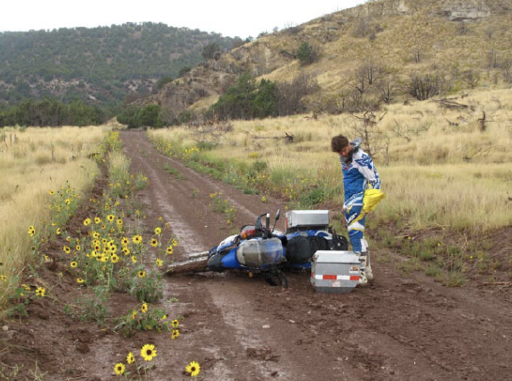
As our misfortune would have it, we hit Bob’s predicted downpour and discovered Utah mud in all its notoriety. Glue might be a better term. Perhaps caulking. Maybe industrial high-strength adhesive. Whatever, it put a death grip on our wheels. In less than fifteen minutes – fifteen minutes! – this infernal goo has reduced both our clutches to Post-it note stickum. My spirits are dashed, deflated, and destroyed as I envision our epic trek, for which I’d planned months and months, reduced to a return home in the back of a truck for lack of a clutch. While I am wallowing in despair, Daniel rises to the occasion and enters command mode. After calling his aunt in Salt Lake, finding repair shops, planning a route to Salt Lake City, and after another McGyver move on the clutches, we limp into Salt Lake City shortly past nightfall.
Within a couple of days of frantic wrenching are back on the road. Now, a decision is needed: to backtrack south on I-70 and pick up the TAT where we left off and probably not make it to Oregon or leap-frog west on I-80 to Battle Mountain, Nevada. Although we hate the thought of missing a few hundred miles of Utah and Nevada, opt for the latter.
Battle Mountain has an image problem. For starters, a prospector christened it in 1866 to commemorate a fictitious battle between a non-existent Captain Pierson and the Indians. To compound the problem, the Washington Post anointed Battle Mountain the Armpit of America. Armpit or not, we aren’t complaining having found a hotel with a laundry, comfortable beds, and a fellow TAT rider to enjoy beers and tell tales over dinner. Once refreshed with a good night’s sleep and energized with a greasy breakfast, we aim off to McDermitt, Nevada.
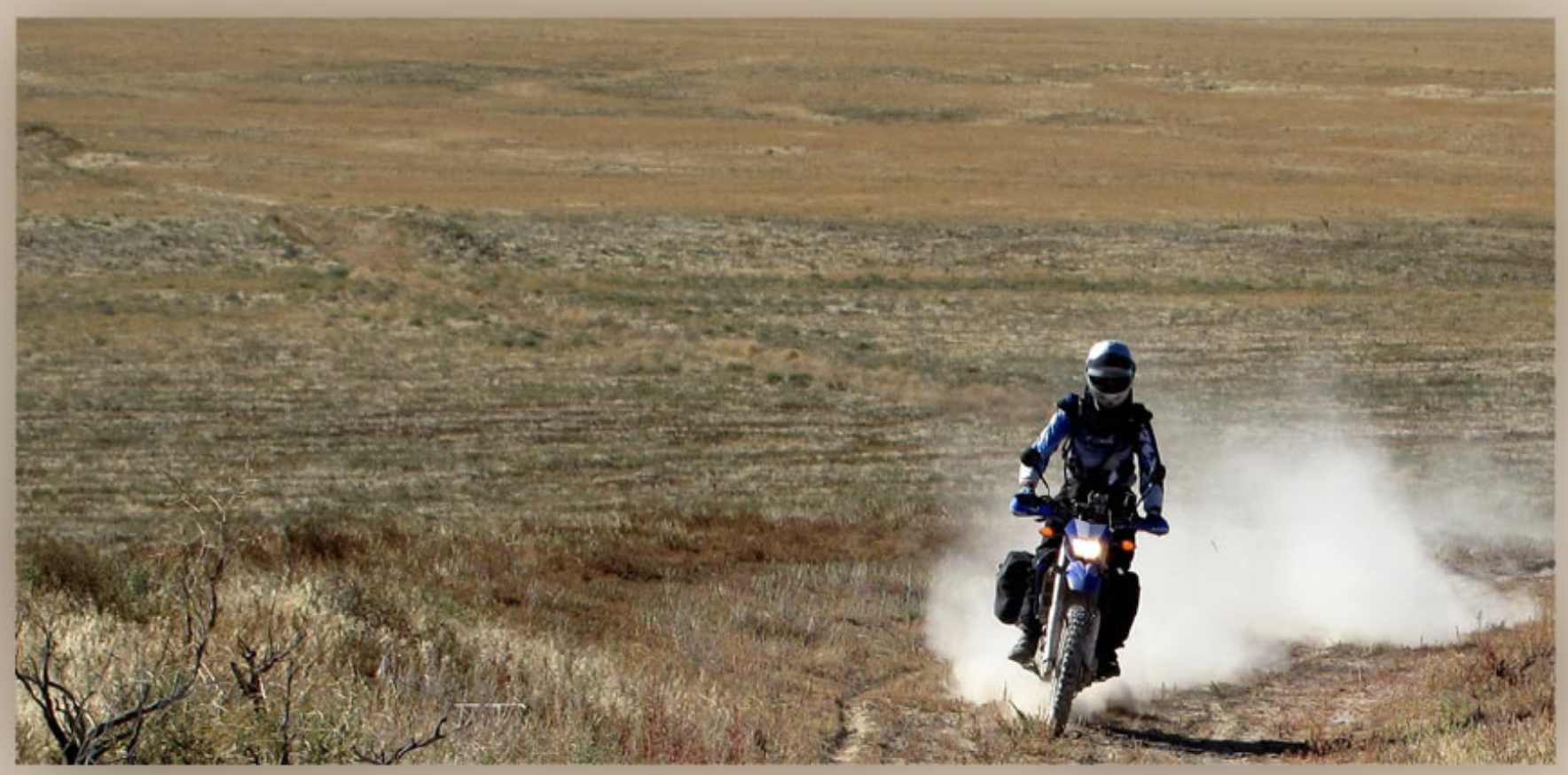
Perhaps the route between Battle Mountain and McDermitt isn’t the most desolate stretch of terrain in the US, but it’s within spitting distance. The path, essentially following the tracks set by a cattle farmer when he pointed his F-150 across the sagebrush in search of an errant head of cattle, holds a mesmerizing beauty in a dehydrated sort of way. One that tests our skills upon long stretches of sand, rock, and powder. Our token human encounter of the day is a rancher almost too perfect to be true: faded cowboy hat, leather gloves, red bandana on the neck, and of course a vintage, battered Ford pickup – complete with a border collie standing guard in the bed.
We roll into McDermitt totally depleted after the toughest 170 miles of my life but delighted to find both fuel and a place to rest our heads. McDermitt is a scant town of 269 souls, a casino, and a convenience store doing a brisk business in economy-sized bottles of cheap whiskey. But once again, exhaustion trumps any complaining.
Our decision not to carry camping gear somewhat limits our choices for overnight stops. From McDermitt, Denio Junction, Nevada is 60 miles away — or Lakeview, Oregon is 220 miles. One TAT lesson is that all trails look pretty much the same on the map. My attempts to guesstimate their degree of difficulty prove to be about as reliable as my stock market predictions in the last few years. So the miles to Lakeview could be a snap or they could put us in an epic post-sunset struggle through sandy sagebrush. We decide to err on the side of caution and commit yet another TAT pavement detour between Denio Junction and Lakeview.
In trip planning, I obsessed about surviving the desert heat in our Imperial Stormtrooper exoskeleton gear. So far, except for a few smoking hot days in Utah, we were mostly cool as cucumbers. It never occurred to me to worry about the other end of the spectrum. But next, there we were freezing our fannies off in the morning chill outside of Lakeview. Daniel, smug with El Pueroco’s heated grips, is at least kind enough to fashion some duct tape mittens over my gloves.
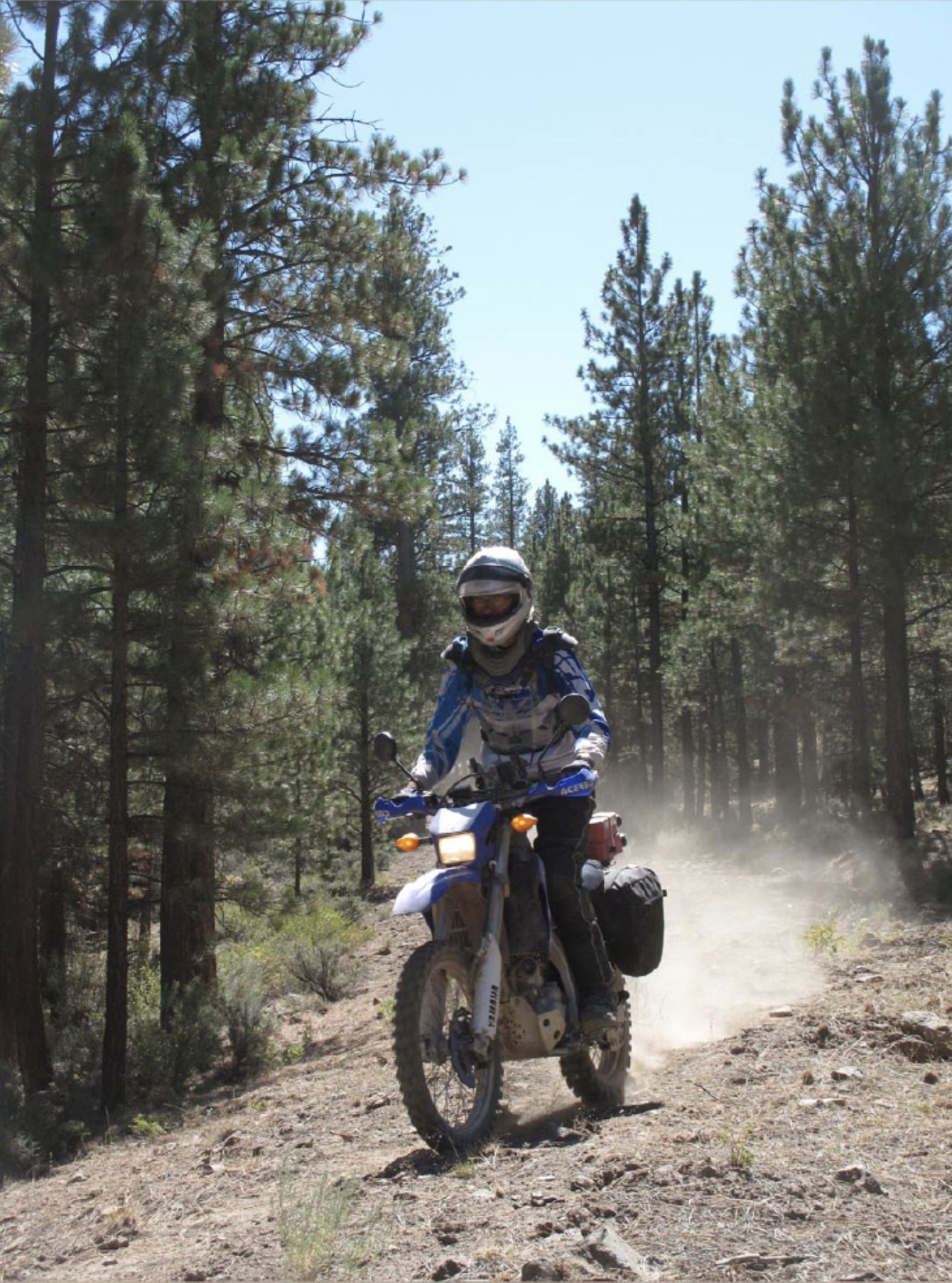
Eastern Oregon turns out to be Sam’s TAT diversity plan — a fine mix of every kind of dual sport riding: forest roads (graded, ungraded), open sagebrush, rocks (large, small, loose, fixed), deep sand – in short, big fun. To top it off, I keep the rubber pointed earth wards an astounding percentage of the time. With darkness approaching on Day 12, two happy but filthy riders ride into Crescent, Oregon and make a beeline for the Woodsman Inn — just in time to see the No Vacancy light pop on as we cruise into the parking lot. No matter, we roll up the road to the Gilchrist Inn, where Marlene sets us up in the Harley Room (even the toilet seat covers are in theme).
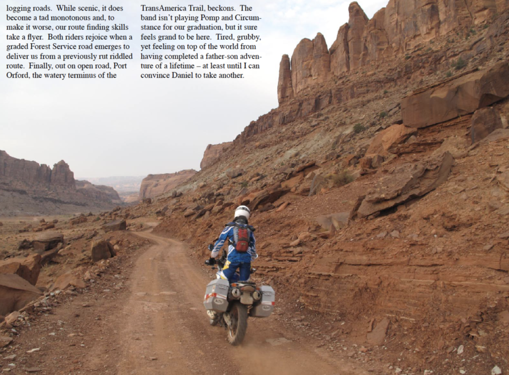
On the trail out of Gilchrist, we are really in Oregon — at least the Oregon pictured by us Rocky Mountain folks: thick conifer forests, deep gorges, roaring creeks, twisty windy roads, trees beyond huge, and clear-cut logging. I can’t comment on the ecological or economic aspects of different logging methods, but clear-cutting transforms a sacred masterpiece into the worst kind of visual wasteland. While the timber companies make every effort to shield their handiwork from the public on paved roads, their destruction was plain as day from our dirt bike vantage point.
Our final day on the trail makes us feel like Dungeons and Dragons gnomes riding through a labyrinth of interlocking logging roads. While scenic, it does become a tad monotonous and, to make it worse, our route finding skills take a flyer. Both riders rejoice when a graded Forest Service road emerges to deliver us from a previously rut riddled route. Finally, out on open road, Port Orford, the watery terminus of the Trans America Trail, beckons. The band isn’t playing Pomp and Circumstance for our graduation, but it sure feels grand to be here. Tired, giubby, yet feeling on top of the world from having completed a father-son adventure of a lifetime – at least until I can convince Daniel to take another.